

Autumn Splendor And The 60th Parallel
Heading West to British Columbia
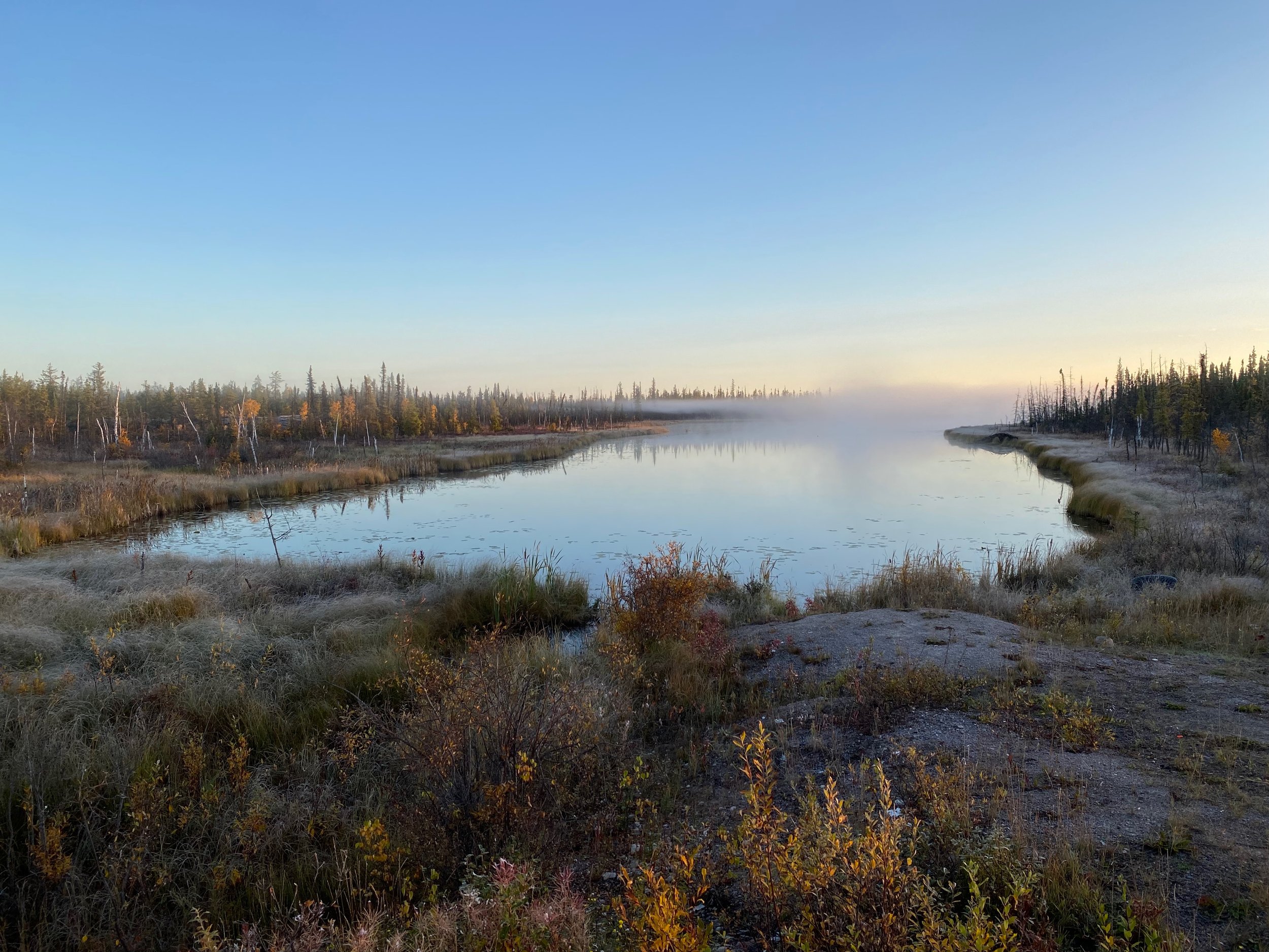
Our best campsite was only 200 metres from the highway beside a small lake.
Finding Our Best Camp Spot
With essentially no remorse about leaving Yellowknife on the same day we arrived, we headed west looking for the place to camp that we couldn’t find in the “big city”. By the time we fuelled up and left town it was already 6:30pm, so we needed to find a place soon or we’d be doing it in the dark. After only a half hour on the highway we found what was arguably the best camp spot of the entire trip.


Our first attempt was across the highway at the usual gravel pit. But a short inspection of that area showed an enormous amount of trash, including TV sets and other large items, all blown to bits with shotguns. There were spent shotgun shells littered everywhere. It reminded us of the back country trash we experienced when off-roading down in the United States. So we knew we didn’t want to be bedding down there. Who knows when these morons would come back with their guns… and probably booze as well.
As we came back to the highway, there was a corresponding side road immediately opposite, so we flipped across to that side and drove in a few hundred yards. Sitting there, all by its lonesome, was the most beautiful little lake with a camp spot right next to it.
The lake’s beauty was made even more so by the fantastic sky and evening light.
Although this pristine lake was amazing to look at in the twilight, it continued to amaze us by providing a moonrise with a clear sky, abundant stars, and yes, even our own personal aurora borealis right at the stroke of midnight. But it didn’t stop there. The next morning, just as dawn was breaking, we had mist on the lake, incredible pre-sunrise cloud illumination, and then through the mist, the burning ember itself. All viewable right from our bed chamber. It’s amazing what you can do with an iPhone camera these days.
Then later, just as we were getting set to leave, a red fox paid us a visit to scavenge from and animal kill that was very close by. You can’t ask for much more than that!


The Long Trek To Northern B.C. And the yukon


Since we couldn’t get to northern NWT and the Arctic Ocean from within southern NWT, we had to head west to British Columbia and the Yukon. It’s from northern Yukon that we can bear east and back into the Northwest Territories and finally to the Arctic Ocean. But it’s a very long drive, over 3,300 kilometres. Almost half of which is off pavement. Although it can theoretically be driven in forty hours, with our truck and questionable road conditions, it would take considerably longer.
Turning left takes one back to Alberta, going right leads to British Columbia.
Our first goal, however was to get back to the junction with Hwy 1. To do this it was a lot of backtracking. First over the rusty Frank Channel bridge at the top of the north arm of Great Slave Lake, and then back over the MacKenzie River via the Deh Cho bridge. Unfortunately, backtracking over previously seen terrain in this part of the territory is not particularly awe inspiring. If it wasn’t for the fall colours and the occasional wildlife spotting, it would have been downright boring. Once at the junction, however, things would start to change as we’d almost immediately transition to an unpaved highway, much of which was being widened and upgraded for some future (and probably highly imagined) onslaught of traffic.


The highway signage for the town of Jean Marie River.
After roughly four hours of gravel road we came upon the turn for the town of Jean Marie River, a First Nation community on the banks of the MacKenzie River. What we found interesting was that the MacKenzie Highway, on which we had been traveling, reverted back to a paved condition at the intersection for Jean Marie River, and stayed paved even past the junction to Highway 7 as it continued north to Fort Simpson. Highway 7, which was gravel, continued west to British Columbia. How far past this junction the MacKenzie Highway remained paved we didn’t know. We turned west off of it to continue on Highway 7 west. So the question is this… why would there be a 30+ kilometre section of isolated paved road that had gravel on either side of it for hundreds of kilometres? I bet there’s a politician in the explanation, somewhere.
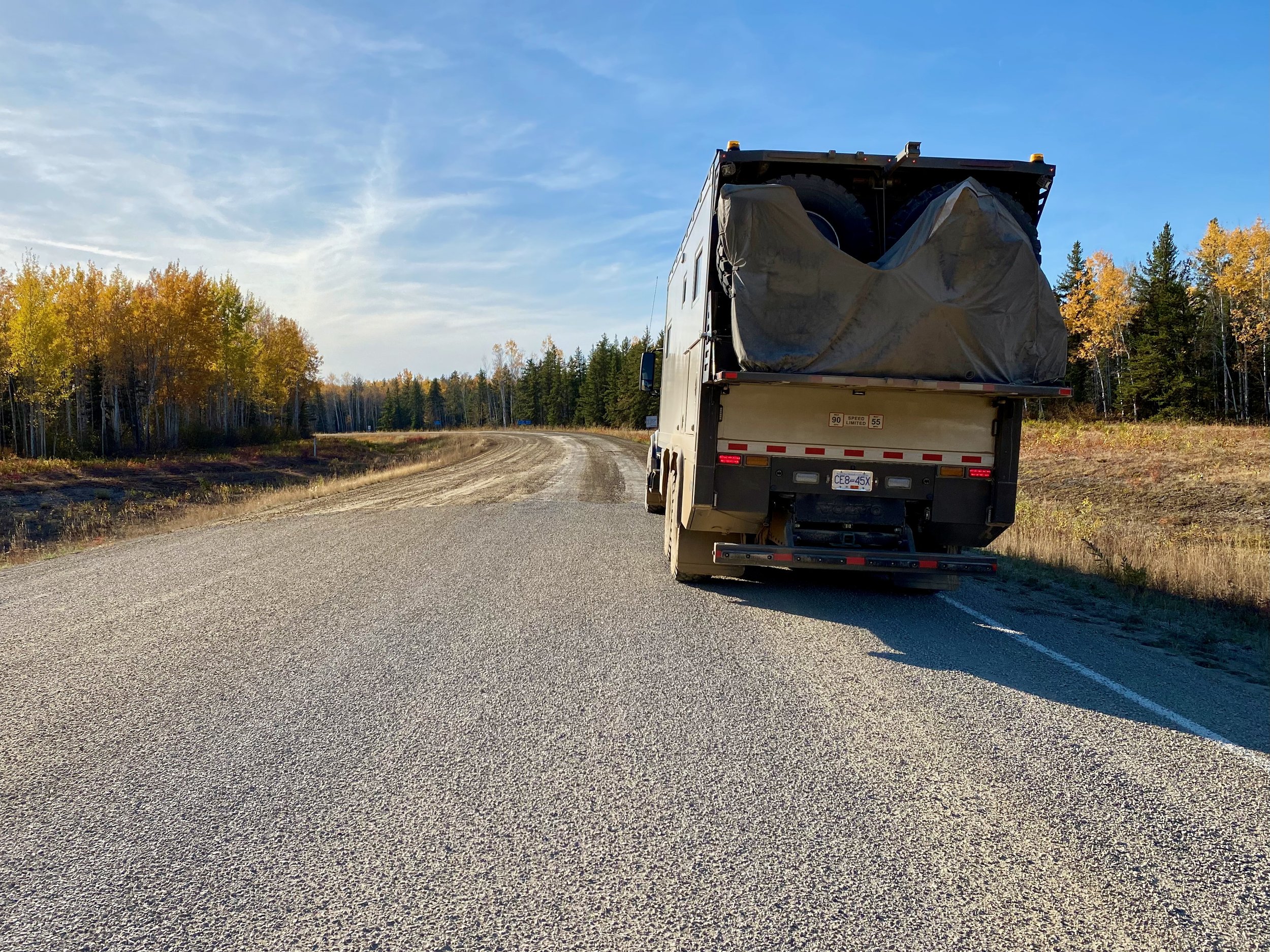
Anyway, since we were once again driving on asphalt we had to stop and refill the tires with air so they wouldn’t be damaged when running on pavement. After traveling the short distance to the Highway 7 junction, we turned back on to gravel. But since we didn’t know when we’d turn back to pavement again, and the gravel road we would be traveling on was very smooth, we elected to leave the tires at the pavement operating pressure of 115psi.


The Liard Trail


On to yet another previously un-driven road.
Once we turned off of the MacKenzie Highway, we began driving on what is technically called Highway 7, but which is more historically known as the Liard Trail. Named after the river along which it follows, the Liard River has its source in the Saint Cyr Range of the Yukon’s Pelly Mountains and travels over 1,100 kilometres through southern Yukon, northern British Columbia and into the Northwest Territories where it eventually drains into the mighty MacKenzie River and eventually, the Arctic Ocean.
What we were looking forward to was how this highway led us closer to the foothills of the Northern Rocky Mountains, and more dramatic scenery. After the flatness of the Northwest Territories, some vertical interest was something we were looking forward to. Like all the roads in southern NWT, the Liard Trail was new ground for us and it eventually hooked us up with the Alaskan Highway about 29 kilometres north of Fort Nelson. There we backtracked a bit to Fort Nelson where we took on diesel and potable water before heading towards Watson Lake and the Yukon.
As we got closer to the NWT/B.C. border the scenery started to get more interesting.
As we traveled along the Liard Trail we witnessed more dramatic autumn colour and some rather spectacular skies. We also got to pay a short visit to Fort Liard, a very small First Nation settlement alongside the river. After our stop we carried on toward British Columbia, along some rough roads that were in the midst of being upgraded. Once past that, and over the NWT/B.C. border, we left the gravel road and once again were traveling on pavement.


