
Winter Ice Road To Fort Chipewyan, Alberta
January 28, 2023
Our route to and from Ft. Chipewyan, Alberta.
Our gps plotted track on the ice road route.
The approved winter road route for 2022/2023 season.
An adventure that’s on many overlander’s bucket list is to one day drive an ice road in the north. They exist all over the world, but ones that are relatively easy to get to reside in Canada and are found in northern Alberta, Yukon, Northwest Territories, northern Saskatchewan and northern Manitoba.
They’re built and maintained by the local governments, often hiring private contractors to build and maintain the roads each winter. The winter road we drove started its build in November, and by late December it was strong enough to take light vehicles. Gradually over the next month the road was strengthened to the point where it could support 45,000 kilograms. This meant that fuel tankers could now make the supply run out to Fort Chipewyan, along with ourselves. We weigh in at 20,590 kilograms.
This years winter road would end up being about 210 kilometres in length from the start of the actual winter road. From Fort McMurray it’s about 280 kilometres out to Fort Chipewyan. In driving to the start of the winter road we passed many of the oil sands projects that supply the bulk of oil for Alberta’s oil companies. But you can’t see much of the projects due to the covering of snow, and the barriers put in place to block access. Our assessment of industry in this part of Alberta essentially showed three main sectors, which in order of importance breaks down to this:
Oil sands collection and extraction.
Logging, to clear the land of all foliage so as to free the oil sands up for industry number 1 above.
Security services to prevent the public from getting access to the oil sands properties in order to witness first had what is being done to the land and environment.
To be clear, the oil sands are south of, and adjacent to Wood Buffalo National Park, Canada’s largest national park, and a designated UNESCO World Heritage Site. So concerned is UNESCO over potential contamination of the park by the oil sands projects, that it wrote a letter to the Government of Canada telling it that if immediate action wasn’t taken to protect the park, it was very possible the World Heritage Site designation would be removed. Although UNESCO was invited by the Government of Canada to proceed with a study, so far there seems to be little government input. Since Canada’s federal government enjoys a huge revenue stream from the Alberta oil industry, is it really surprising that little is being done?
The Journey To Northeast Alberta
Our original route to Alberta.
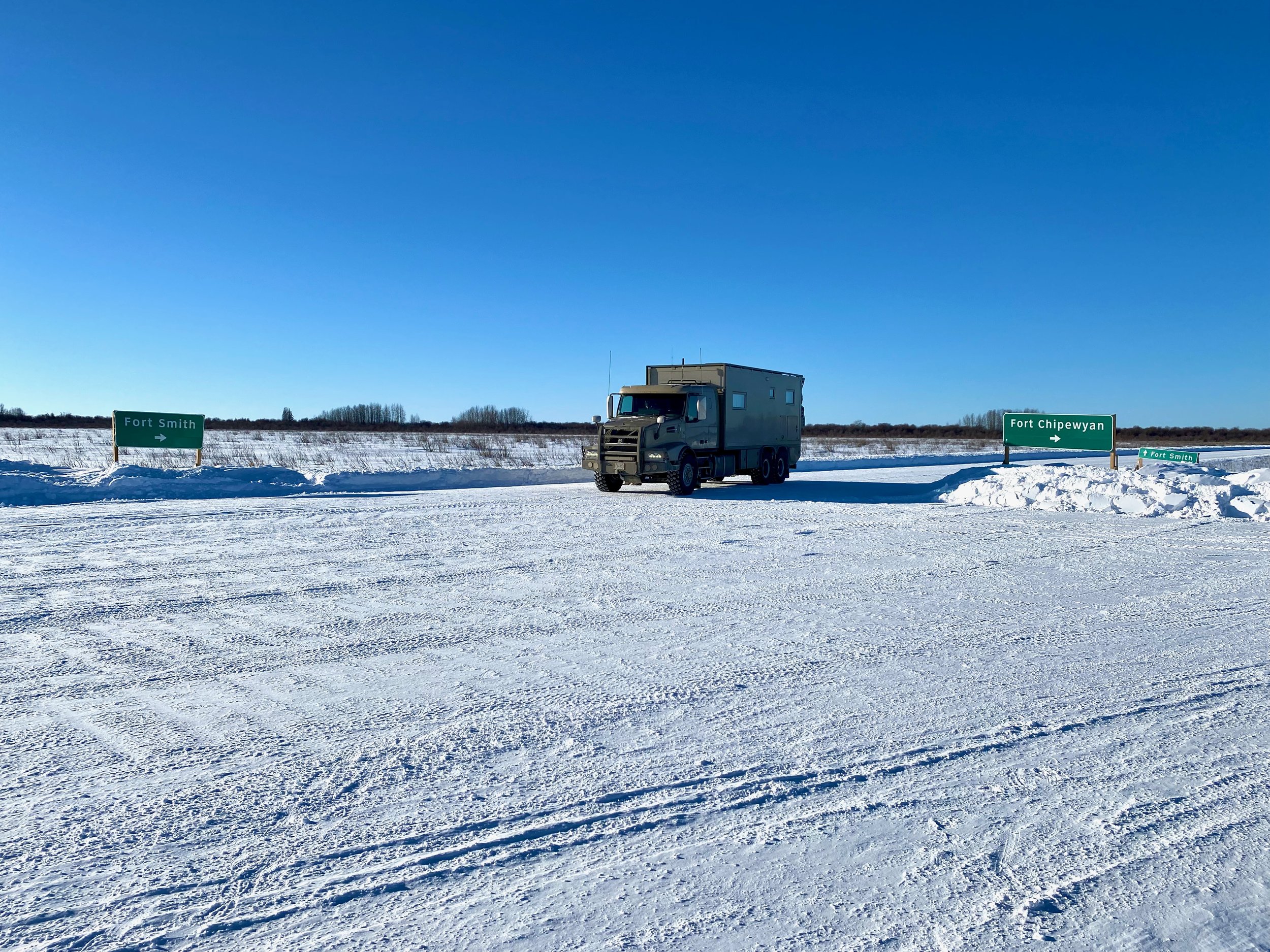
The trip to get to the ice road was a rather circuitous one. Since our goal had been to see Fort Chipewyan via the winter road, we planned to make our way into Alberta on a route we hadn’t taken before. That being Highway 11 from Saskatchewan Crossing in Banff National Park over to Rocky Mountain House, then on to Edmonton. However, while on route we got notification that the northern leg of the ice road, the one that goes from Fort Chipewyan to Fort Smith in the Northwest Territories, had been damaged and was closed. Since we wanted to drive both sections of road, we decided to leave the ice road for the time being and instead head up to the Arctic Ocean via the Dempster Highway.
Vancouver to Beaverlodge
Our amended route to Alberta.
What our engine diagnostic device was telling us about our engine problem.
Since mid-commute we changed our plan to go northwest instead, we by-passed Saskatchewan Crossing and continued on to our usual route which went north to Jasper, and then east into Alberta. Once in Alberta proper, we took our usual route north on old Hwy 40, just before reaching Hinton. But here we had an unforeseen issue.
When we entered Banff National Park the outside temperature was -10ºC, and we had our front grill winter cover on and mostly zipped closed. But by the time we got close to our turnoff to Grande Prairie, east of Jasper, the outside temperature had risen to +3ºC and a fault code popped up on the dash warning us something was wrong. Of course because of the winter grill cover, the engine now thought the outside air was at +40ºC, and the engine management system had a fit. We didn't know that the outside air temperature sensor actually did more than just tell us the temperature. It apparently tells the engine computer what it should be doing for any particular outside temperature. Our engine tried to do that, and the code it triggered was for a turbocharger/supercharger overboost condition. We immediately pulled over and a few phone calls later had determined that we could continue our journey, but would need to stop in Grande Prairie at the Volvo Truck dealer so they could check things out. Fortunately, the only problem was we had covered the sensor, and shouldn’t have. Once we folded the winter cover open in the corner to expose the sensor, everything worked fine with no damage.
After a brief stop in Grande Prairie at the Volvo dealership to get the engine fault checked, we started making our way west over to Dawson Creek where we would connect with the Alaska Highway. It would take us north to the Yukon, and eventually the upper part of the NWT via the Dempster Highway.


Reversing course
It was nice to see that Foster’s Feed & Seed was doing well in Beaverlodge.
After a quiet night camping in Beaverlodge alongside the highway, we took stock after breakfast and discovered two things. One was that the northern ice road was once again back open, albeit only for vehicles up to 10,000 kilograms. The second, was that it was extremely cold in Tuktoyaktuk on the Arctic Ocean.
Looking at the Arctic weather forecast, and seeing temperatures hovering around -41ºC with wind chills at -49ºC and below, we chose the better part of valour and decided to reverse course back to northeast Alberta and the road to Fort Chipewyan. We’ve proven the truck down to -25ºC, but we just didn’t want to deal with -42ºC thank-you very much. For temperatures that cold it’s imperative that you travel in a convoy when in remote regions. The reason for this is quite simple… survival. If a truck breaks down, the occupants need something else warm to evacuate into. In temperatures that low, a vehicle without an operating heat source will cool down rapidly, and the occupants could perish from hypothermia in a matter of hours. Since we’re traveling solo, we just couldn’t go north in those conditions.
Although the northern section of the Fort Chipewyan ice road wasn’t strong enough yet to hold our weight, we hoped enough time might pass by the time we got there for it to be strong enough for our 20,590kg weight.
Beaverlodge to Athabasca
Our route across Alberta to get to where we can head north to Fort McMurray and the ice road.
The rough and ragged bare ice on Lesser Slave Lake at Canyon Creek.
Heading back east, considering our current latitude, would take us well above the main city of Edmonton, and through another section of Alberta for which we had yet to travel. Specifically, this would take us past the rather substantial Lesser Slave Lake. A mere shadow compared to Great Slave Lake in the Northwest Territories, it nonetheless is a formidable body of water which, at this time of year, is frozen solid. Covering 1,160 sq.km. (450 sq.mi.), it’s 100km long and 15km wide at the point where we visited the lake shore. So it appears to go off into oblivion when staring across the ice. We visited a few of the towns along its southern shore, and the view of the lake was completely different from one location to another.
The perfectly smooth and soft looking Lesser Slave Lake as seen at Spruce Point Park near Kinuso, Alberta. The distance from Canyon Creek (previous photo) is just 25 kilometres.


Happily we get to see a couple of living wildlife creatures near the highway.
After leaving the Lesser Slave Lake area it was just kilometre after kilometre of straight, boring road with farmland on either side. On occasion we were lucky enough to see some wildlife either alongside, or crossing the highway. Unfortunately, was also saw many examples of wildlife that picked the wrong time to cross. Most likely done at night.
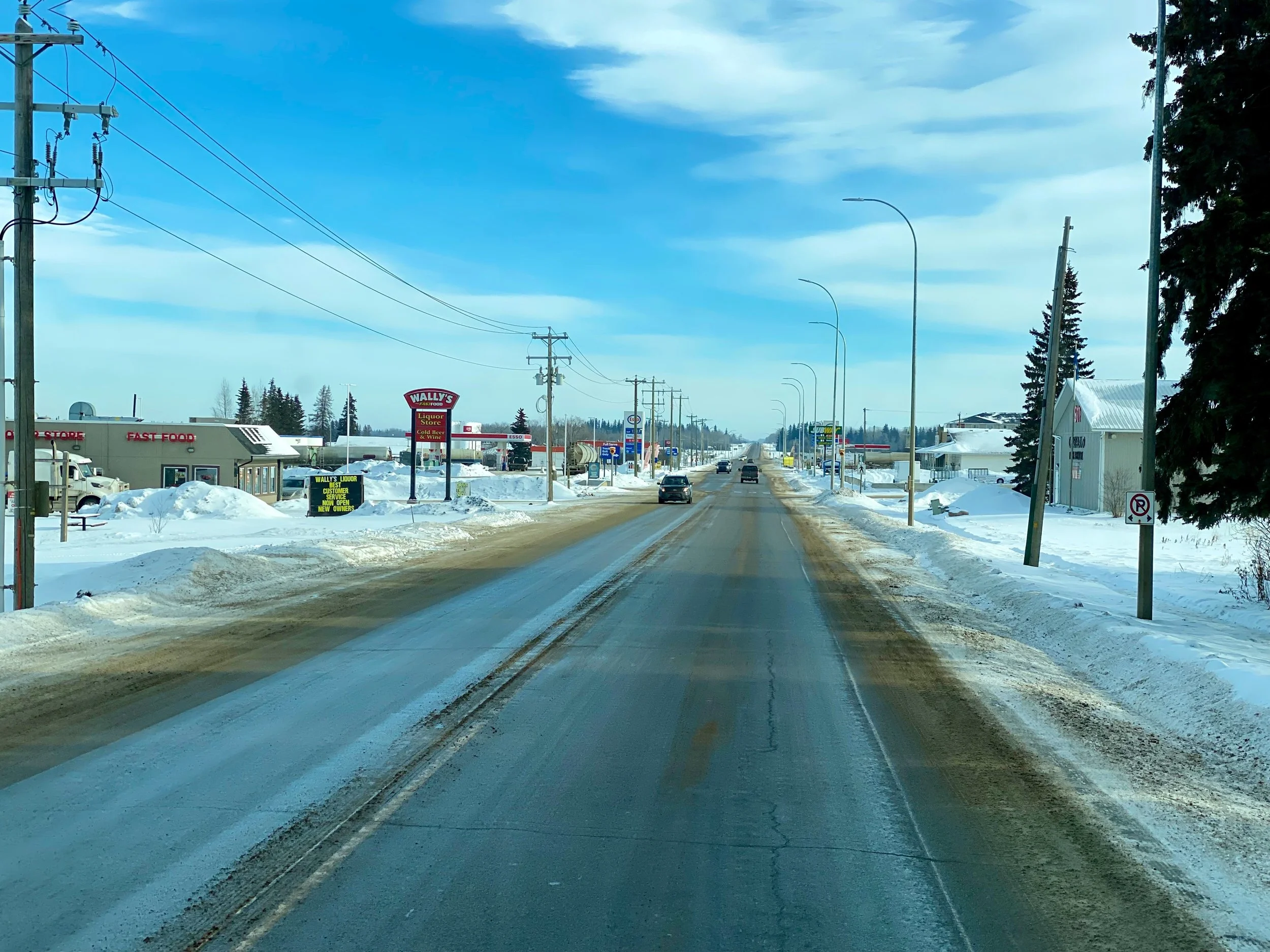
From time to time we would pass through another tiny town that provided mostly a fuel station for the local farmers, and the requisite fast food joints to ensure the population had convenient, but far from wholesome food to wolf down while getting the load of fuel. We just kept on driving, as we fuelled up in Grande Prairie and wouldn’t need to fuel again until we reached Fort McMurray. Even then, though, we’d still have 5/8 of a tank. We’d only fill so we could make it out to Fort Chipewyan and back. There’s no diesel available for us there, nor would we want to take any from the community. After all, the whole reason for the winter road is to take fuel into the town, not out of it.


Athabasca To Fort McMurray
The route up to the area of the oil sands, and the wildfire ravaged Fort McMurray.
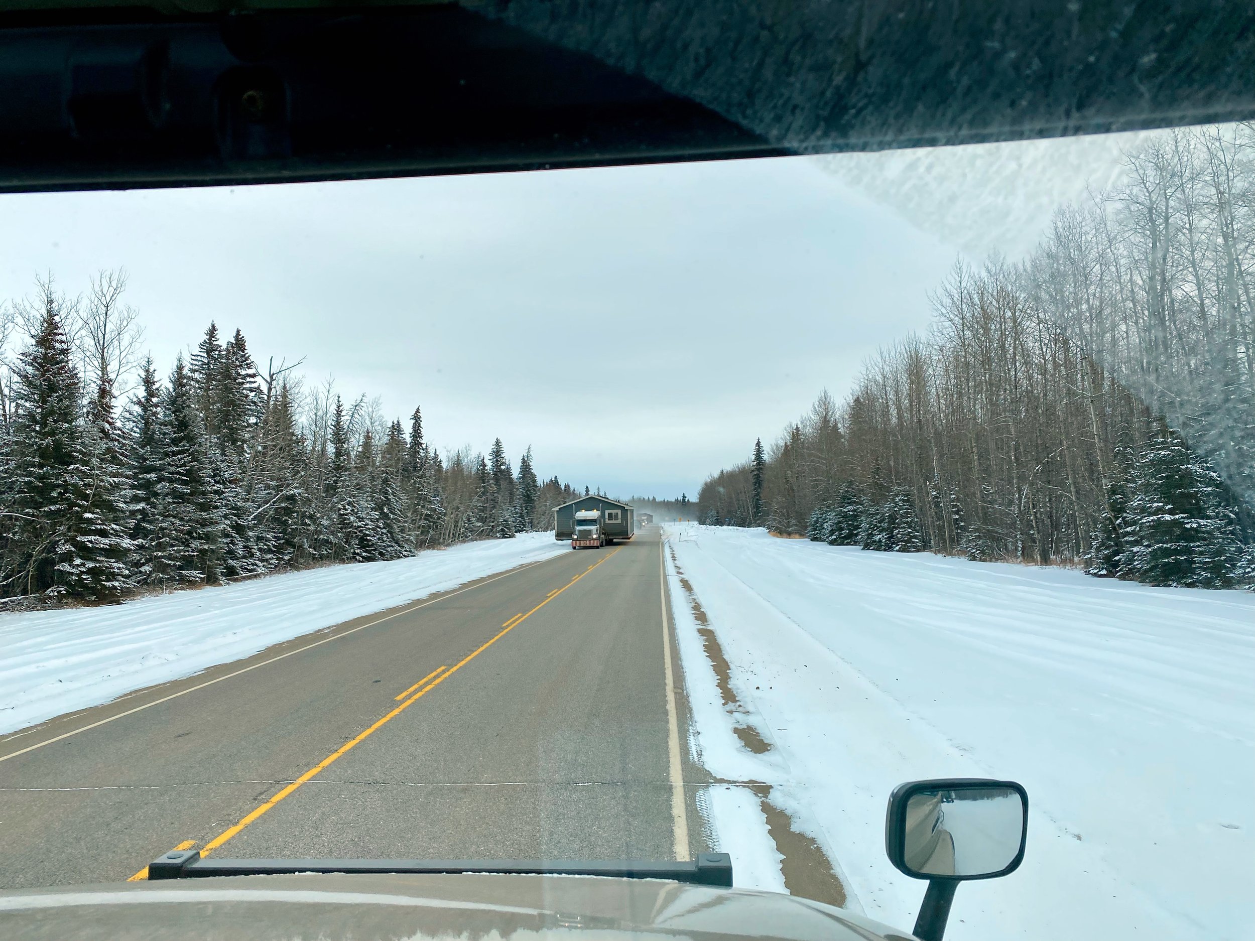
The last stretch of normal highway before we reached the winter road to Fort Chipewyan was Highway 63 which stretched north from Athabasca. Fortunately this road was relatively new, obviously being upgraded to a four lane divided highway to facilitate heavy truck travel up to the area of the oil sands. Unfortunately for a tourist, its not particularly attractive scenery. Most is open farmland with little topography or natural landscapes to enjoy, and much of the treed landscape was destroyed by wildfire. Nevertheless, the drive went by quickly and we found ourselves in the wildfire ravaged community of Fort McMurray.
Taking on a full load of diesel in Fort McMurray for the trip to Fort Chipewyan. There is no fuel available to the public north of here. Small retail pumps means standing around in the cold for enough time to make bundling up necessary.


Fort McMurray To Fort McKay
This is our plotted track as we made our way north from Ft. McMurray.
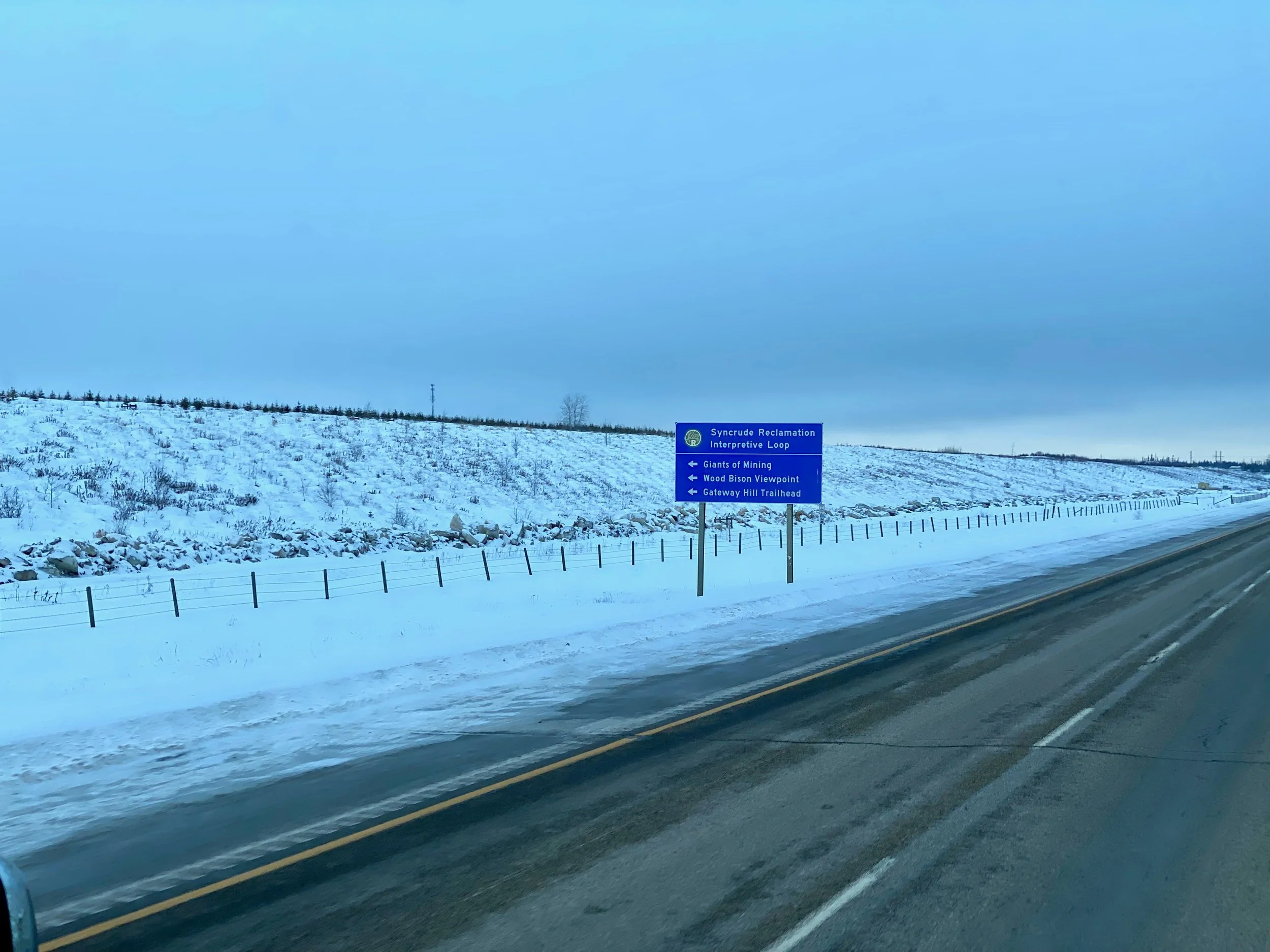
It only takes a few hours to drive from Fort McMurray to the start of the winter road. But for us it took longer because of a few stops to see Fort McKay, an indigenous community along the way, some support businesses for the oil sands industry, and hopefully some of the oil sands projects if we could. Little did we know that seeing the oil sand projects was quite impossible. Their security was, after all, the number three industry in this region of Alberta.
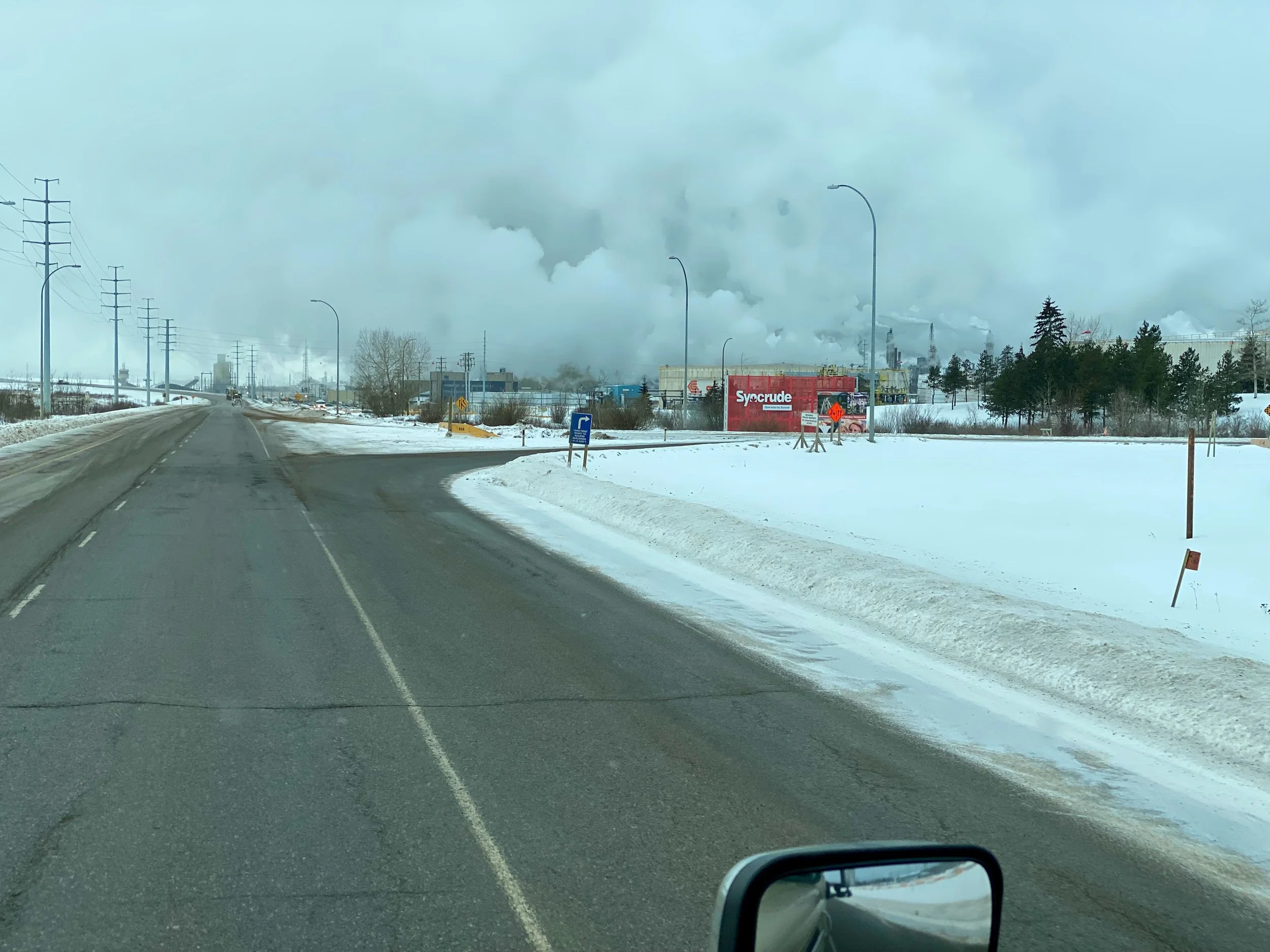
On route to Fort McKay we passed by a large facility that was apparently a reclamation plant for a Syncrude mine that we assume had played out. This was the process of returning the land back to nature. Although it was as far from natural as one can imagine. In fact, it looked rather hellish with all the dark emissions emanating from all of the stacks. Combined with the low, heavy cloud cover it was a troubling thing to see indeed.
The rather apocalyptic looking scene of the Syncrude reclamation project from across the plain.


It’s interesting that although the residents here come from Dene, Cree and Métis decent, only Métis appears on the town sign.
Fort McKay
Fort McKay is an indigenous community about half way between Fort McMurray and the start of the Fort Chipewyan winter road. It’s home to about 800 members of Dene, Cree and Métis descent, and lies at the confluence of the McKay and Athabasca Rivers. From what we saw, it was a well maintained community with modest modern homes, and new community facilities for education, recreation and civic events. We were able to drive fully around the community and down alongside the Athabasca River, which of course was all frozen over.


Our parking spot for the night in the industrial park.
By the time we had finished our side trips, and our drive around the community of Fort McKay, it was mid afternoon. Since we were tired from many days of continuous travel we elected to call it an early day and started looking for a place to park for the night. Luckily just up the road to the north of the Fort McKay turnoff, there was a large industrial park. We thought we might find a spot at the end of one of the roads to park out of the way of everything, and that’s exactly what we were able to do. At the end of the main road that travelled the length of the industrial park there was a side pullout to an area where they had been dumping the snow from plowing the roads in the park. It had the perfect spot for us to tuck into, and since all the roads were already clear of snow, we knew we wouldn’t be disturbed by dump trucks coming in to offload any snow they had collected. Also, being at the end of a dead end road, we knew there wouldn’t be any noise from large vehicles travelling past us on route to some other location in the area.
As per usual, we were able to jockey the truck into the perfect position so that we were totally level. It’s surprising how often we can level the habitat without using jacks or blocks.


Fort McKay To The Start Of The Winter Road
Our route to the start of the winter road to Fort Chipewyan. It leads past all of the oil sands projects.
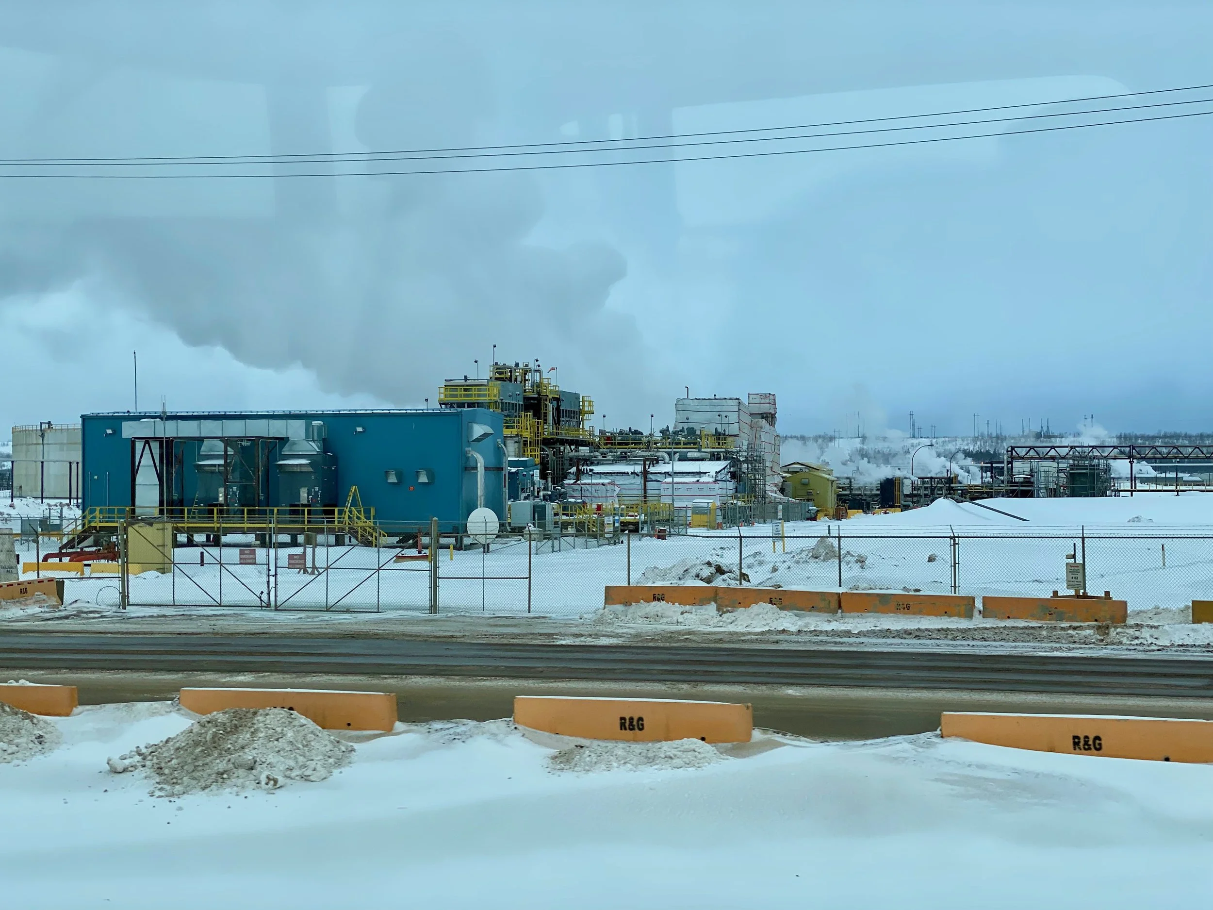
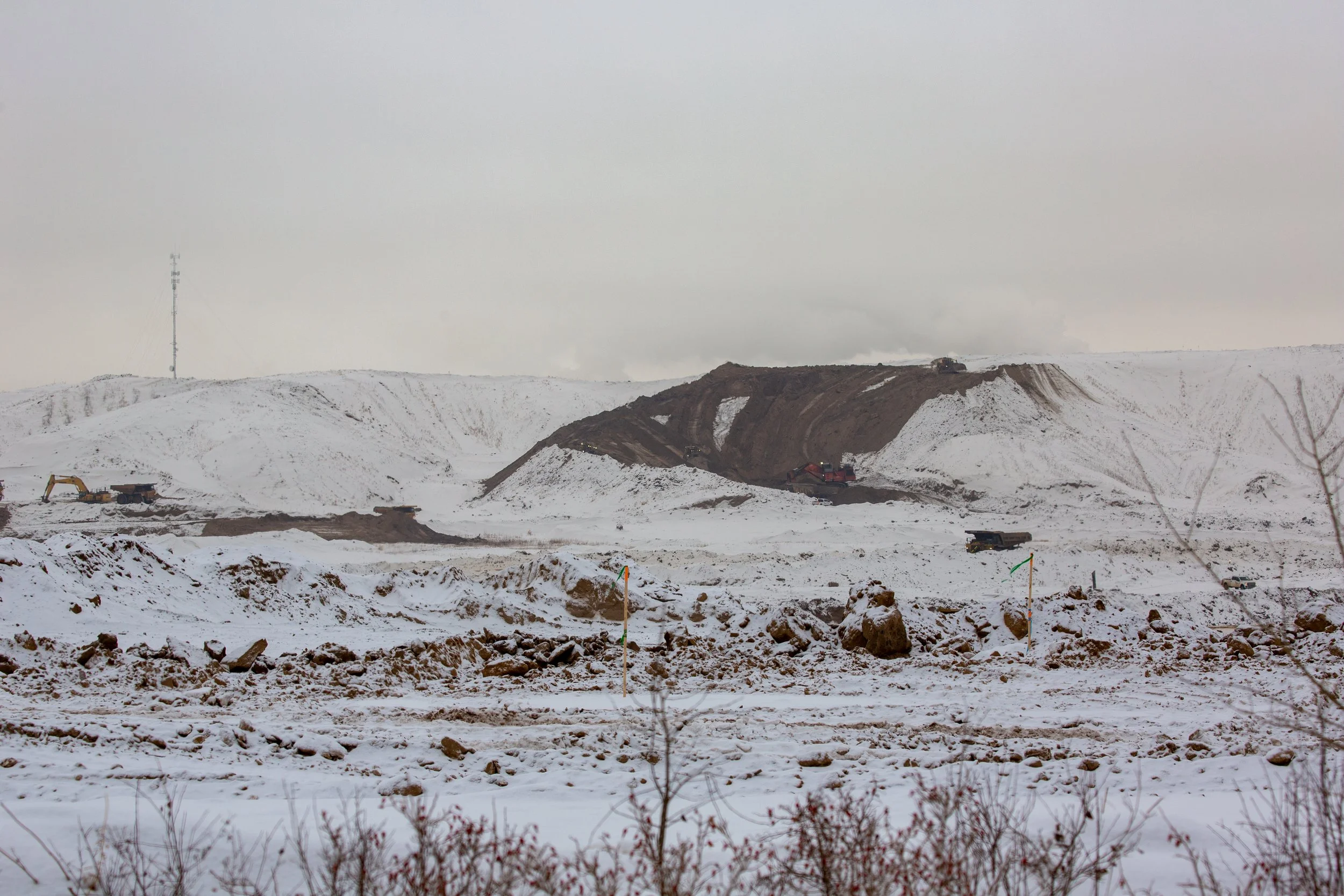
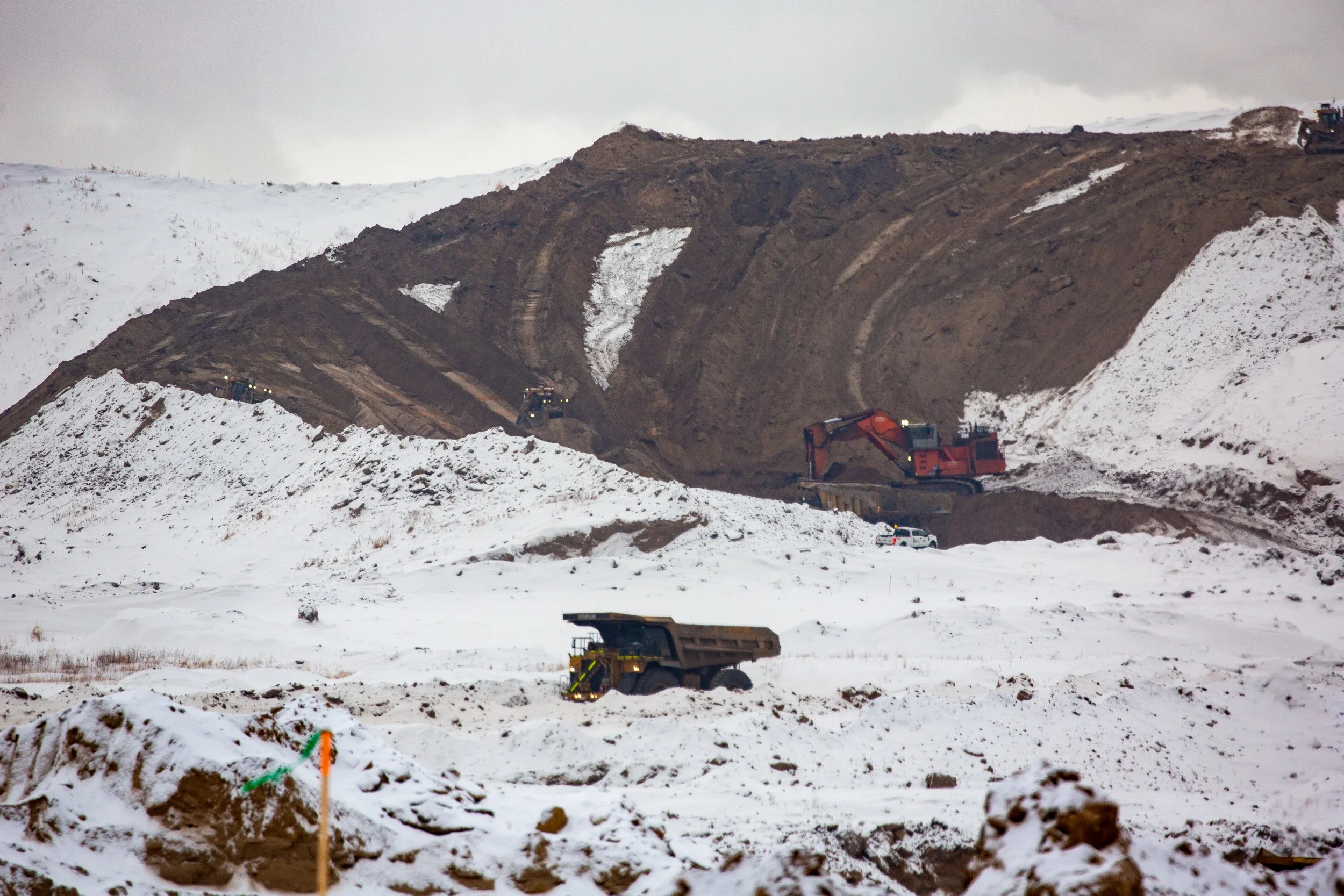
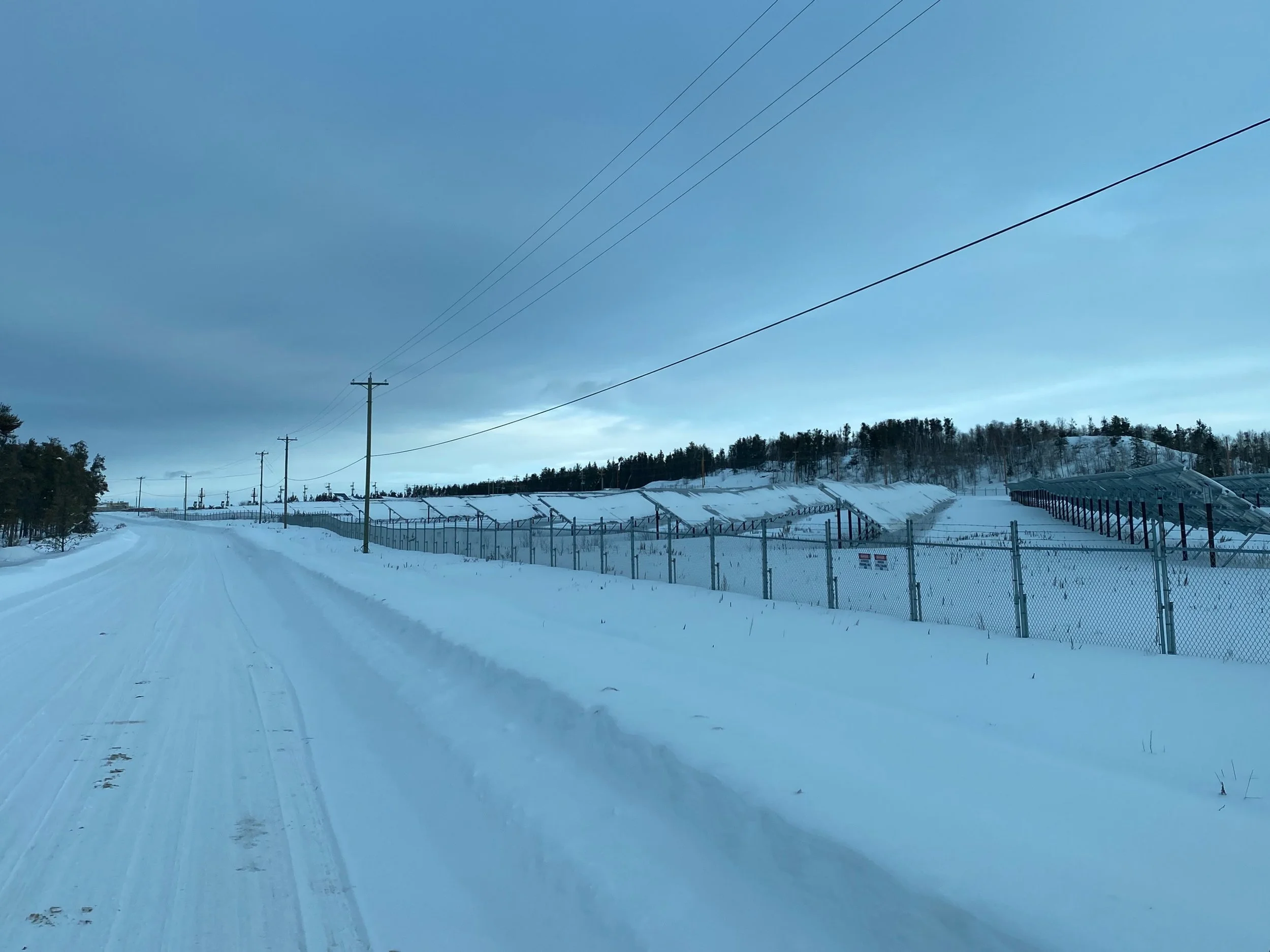
After a good nights sleep, we left our camp spot in the industrial park and headed further north to the start of the winter road. Along the way we passed a major Suncor mining site. Although we could pull into the visitor parking lot, we weren’t able to get past their security gates. So we sat in the lot and took what photos we could of the operation.
From what we could see, there were large bulldozers up on the hill plateau that would push the sand off the upper level and down a bank to where a very large excavator would scoop it up and load it onto the enormous dump trucks that would then cart it off to the processing facility. This facility was so far away that it was hard to see, even with binoculars and a super long telephoto lens.
This was as close to the operation as we could get. Look at all the power poles.


As we continue north we see that there are even more employee housing encampments way out here. This one looked as if it was constructed of pre-manufactured container like modules that were stacked and aligned to create a village. Once again, we could only look at it from the road as we drove by on our way to the winter road gate.


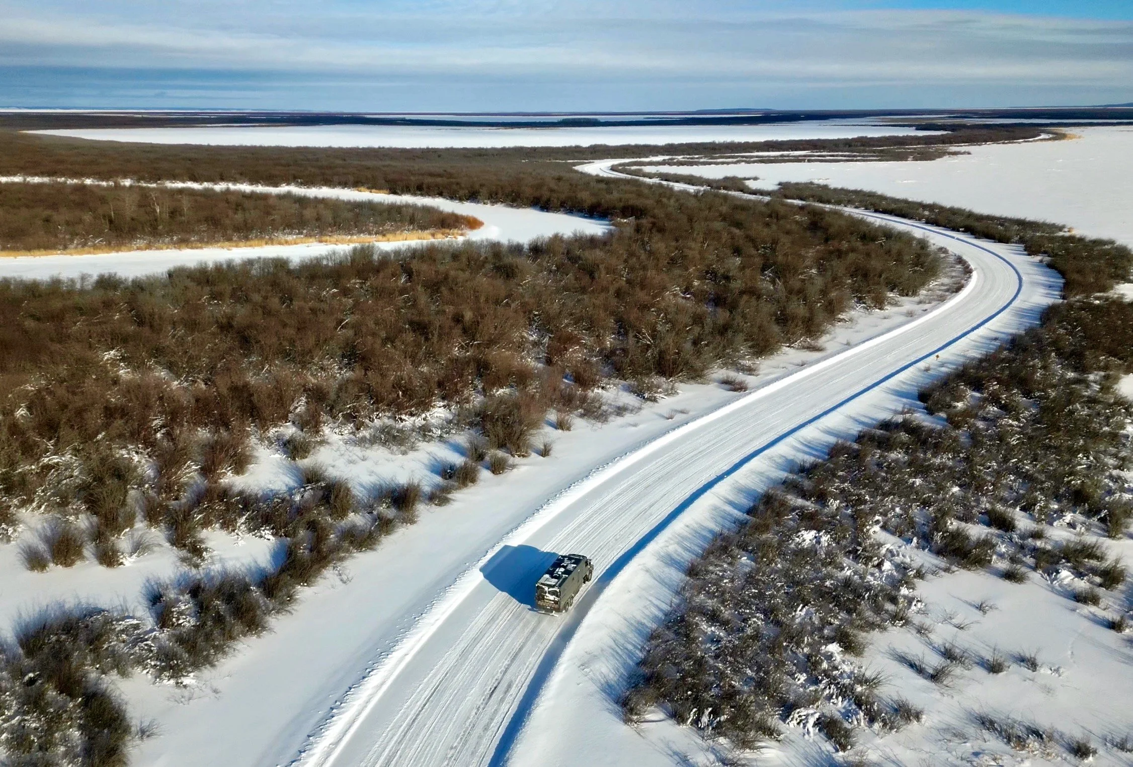
The Winter Road To Fort Chipewyan
This is our gps tracked route along the ice road, and the points of interest along it.
Day 1 on the winter road
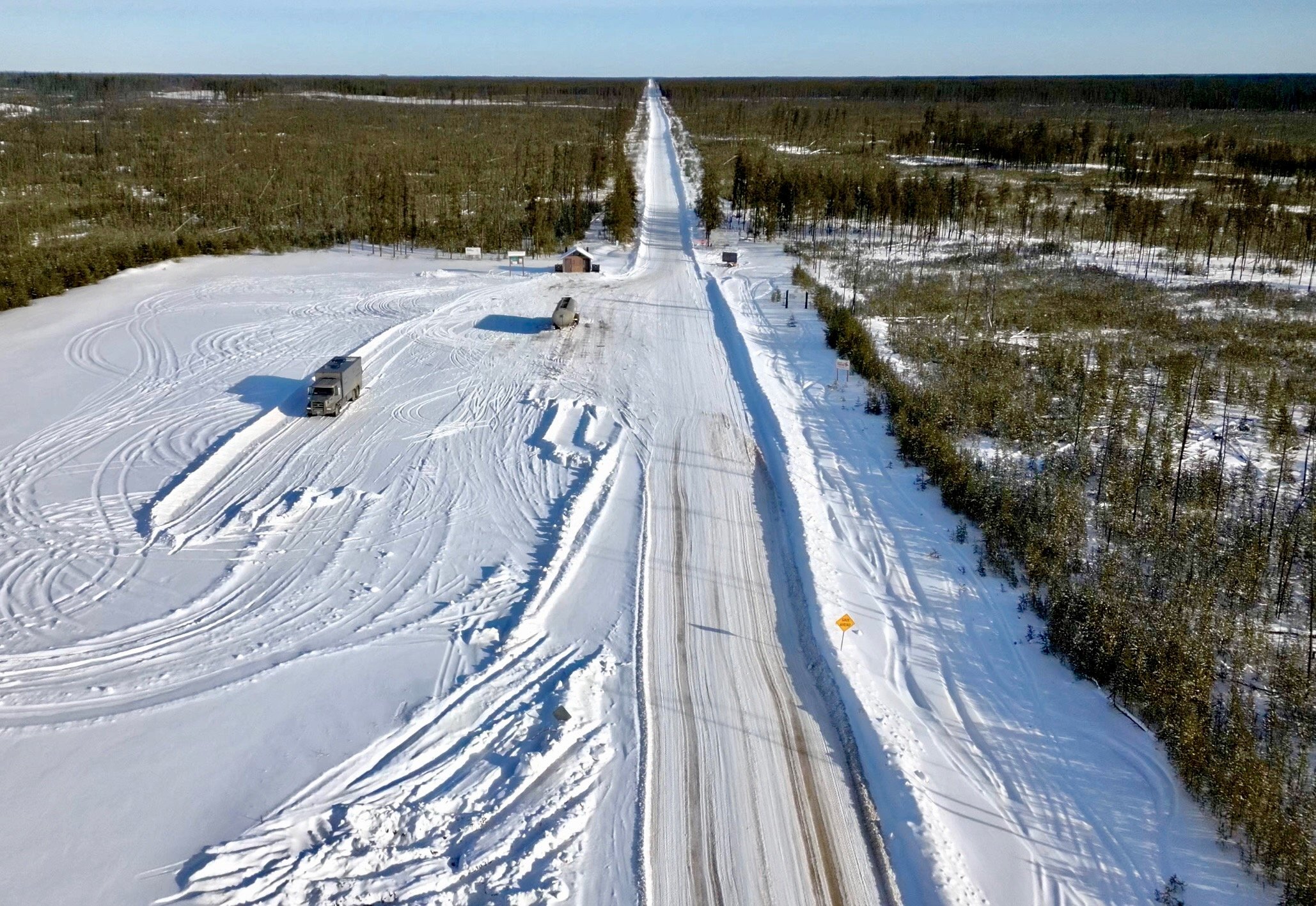
We arrived at the gate to the winter road just about lunchtime, and we pondered for a bit as to what to do. Should we just continue on, or should we park here for the rest of the day and night, and then continue fresh in the morning. Since we didn’t know the road, and what opportunities there would be for camping, or how far along the road the first one would be, we elected to do the safe thing and stop here until the next morning. Besides, we had to let the air down on the tires so the ride would be smoother for us, and it would also give us more traction and distribute our weight out over a larger tire footprint. Not that we were anywhere close to the maximum weight rating, you understand. Besides, the weather and mood was dark and gloomy. We hoped waiting until the next day would bring better conditions.
Our spirits were lifting as the clouds started to break and the gloom was pierced by the last few rays of the sun. As a bonus, we got some pointers from the tanker truck driver about the road.


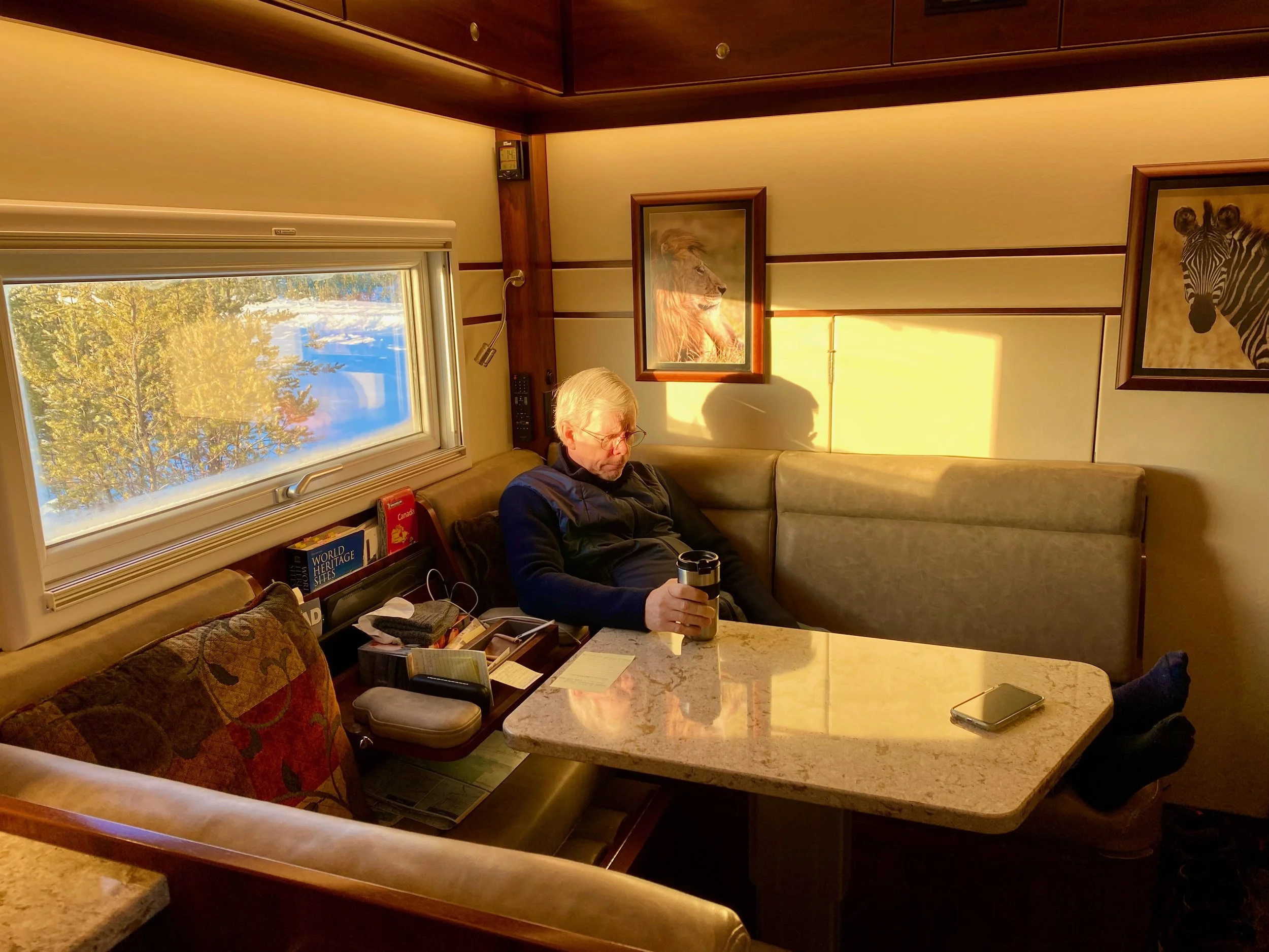
Well our patience and decision to wait for the next morning paid off in spades. We awoke to a beautiful sunny sky, with crisp white snow all around us. And something we’ve never had before. A moonset on one side of the truck, with a sunrise on the other. All viewable from our two bedroom windows. This is when it pays to take your iPhone to bed with you. We could get terrific photos of them without even getting out from under the covers. Perfect! We took it as a good omen for what was to come.
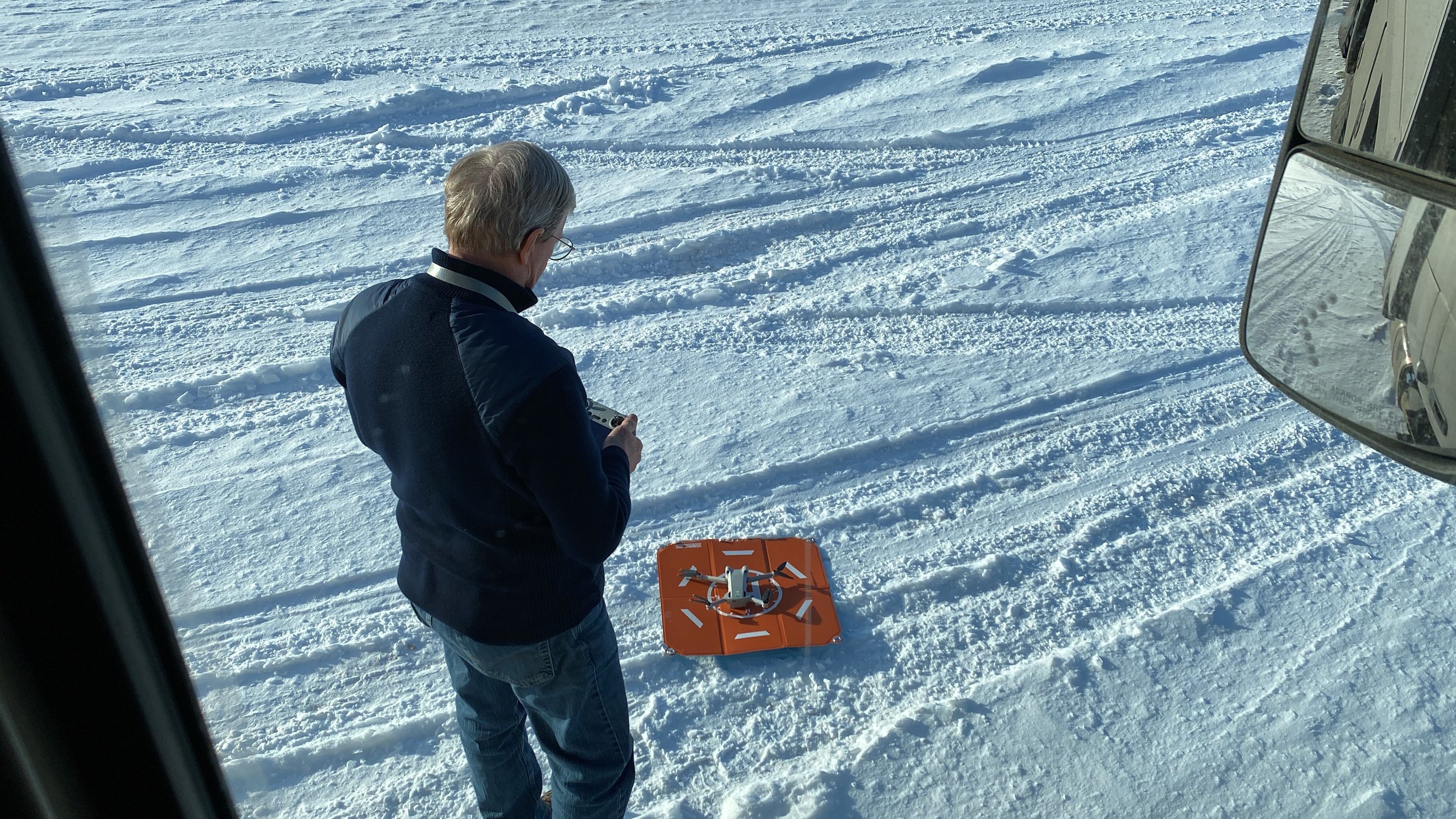
After getting breakfast, and setting our Stationary Tire Inflation System to 45psi (roughly 3 Bar), we hooked up the hoses to the wheels and let the system air us down. While that was taking place I got our new drone out (the tiny DJI Mini 3 Pro) and got it up into the air for a birds eye view of our location and a view along the road we would soon travel. The little wonder worked like a charm and didn’t mind the cold nearly as much as my bare fingers did in the -12ºC air.


The narrowing at the crest of a hill.
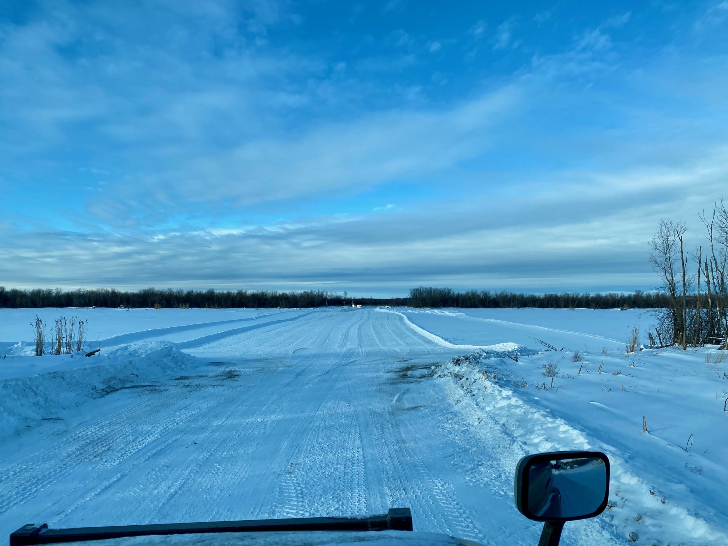
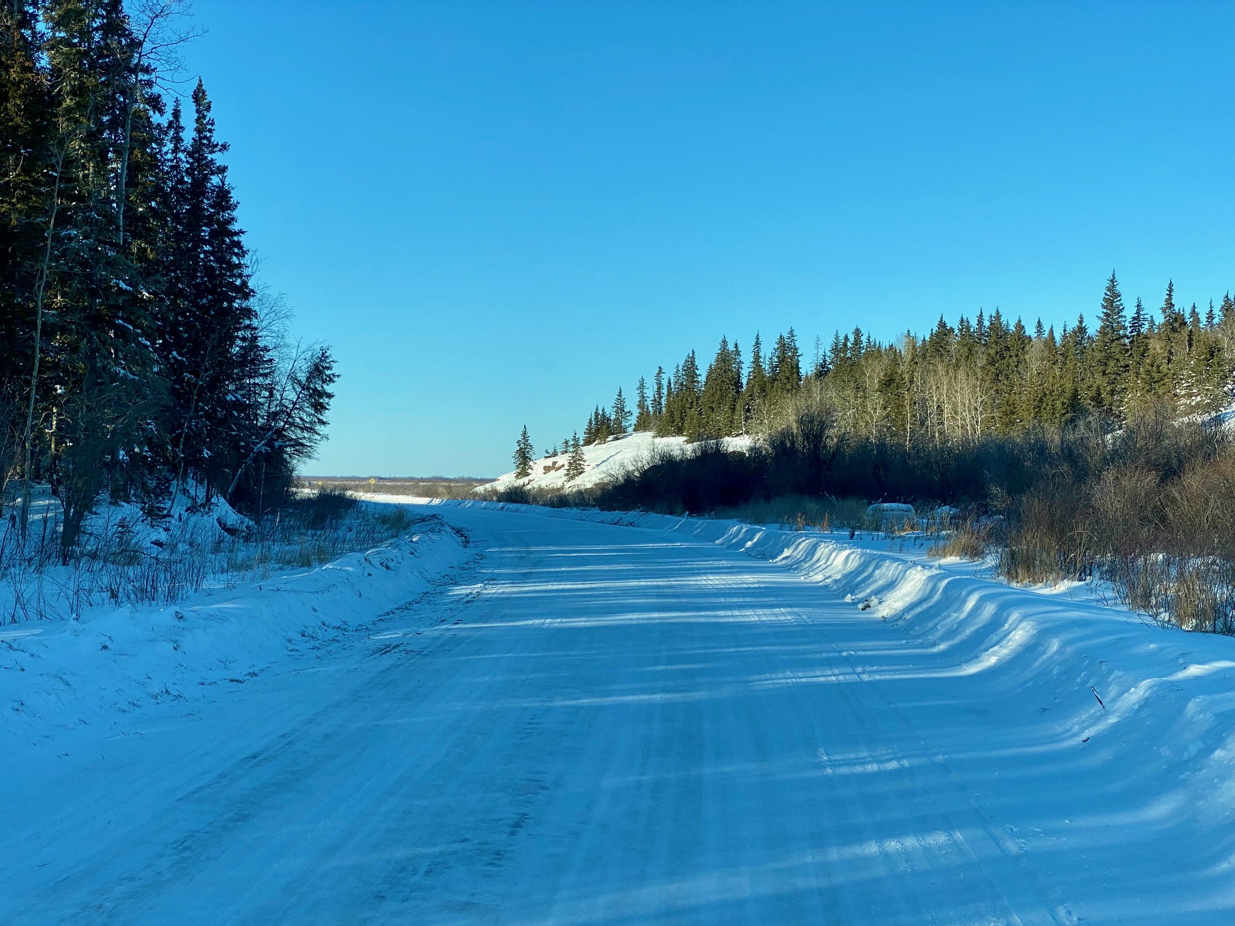
Without further ado, we headed onto the winter road, eager to find what awaits us. Mostly, it was just like driving on a snowy road. Some sections would see the snow worn off with ice poking through from beneath. But for the most part is was an easy drive with the only real annoyance being the washboard effect from the smaller vehicles traveling at higher speeds. Since we weren’t in a hurry, we just poked along at an average speed of 50 to 60kph. Many places though we’d slow down for safety reasons, like when cresting hills. For some strange reason, whenever these hill crests presented themselves, the road would narrow right at the crest effectively pushing the opposing vehicles closer together. Doesn’t that seem a little counter intuitive? One would think it would be the opposite so there would be less chance of a collision.


And here’s the reason to stay well to the right when cresting those hills. These two empty tanker trucks blew by us doing 75 or 80kph.


Day 2 On The Winter Road
The linear striations from the tree shadows was quite something to see.
After a leisurely breakfast, we headed back out onto the road for the rest of the journey to Fort Chipewyan. Like the day before, we had clear blue skies with bright sunshine reflecting off the snow all around us. Before getting underway we put the drone up to get a birds eye view of the area and our camp spot. One of the unique things that we spotted right away was the linear striations that the slender trees cast upon the ground due to their sparse nature and the low angle of the sun above the horizon. Although this did depend greatly on where we were. Only a few hundred metres away on the other side of the road the trees were much denser, and with more foliage, so the zebra effect wasn’t apparent.


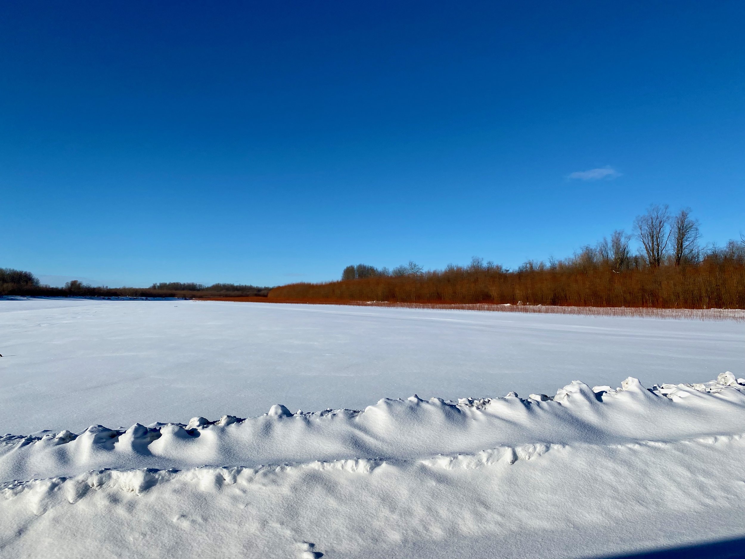
Our second day on the winter road saw us encountering a vast area of wetlands, rivers and lakes, all frozen.
This day would prove a bit more exciting compared to the last since we would meet the actual road builders along the way, as they started to create a bypass route to get around some beavers that were damaging the road. They didn’t like how the road was affecting their pond making, so they took it upon themselves to redirect the water flow so it topped over the road. Since current policy was not to remove the beavers, they had to move the road away from the beaver’s area. Today would also see us actually driving across the frozen lakes, and more importantly, the fragile river crossings. With the latter, a truck our size can only travel at 5kph (3mph) in order to prevent damage. This is strictly enforced with zero tolerance, and our first experience would be Athabasca River. A river we’ve already crossed numerous times on the main highway, using a conventional bridge.


This driver was burning daylight, as they say, so had no qualms about blowing by us at full speed. We were literally left in his dust.
Having made it across the first real river, as opposed to a creek, we transitioned from the more hilly terrain down onto the wide marshland of the Athabasca delta. For much of this period we are crossing larger lakes where it’s difficult to differentiate between lake, marsh and land. Since lakes are static bodies of water, their ability to freeze thicker is much greater than the rivers. So on the lakes at least there was no reduction to the regular speed limit. The lakes could apparently hold heavier vehicles as well, since we got passed by a fully loaded fuel tanker, in the middle of Galoot lake, traveling at Mach 2. Fortunately the lake didn’t crack open and swallow us up, and we lived to drive another day.


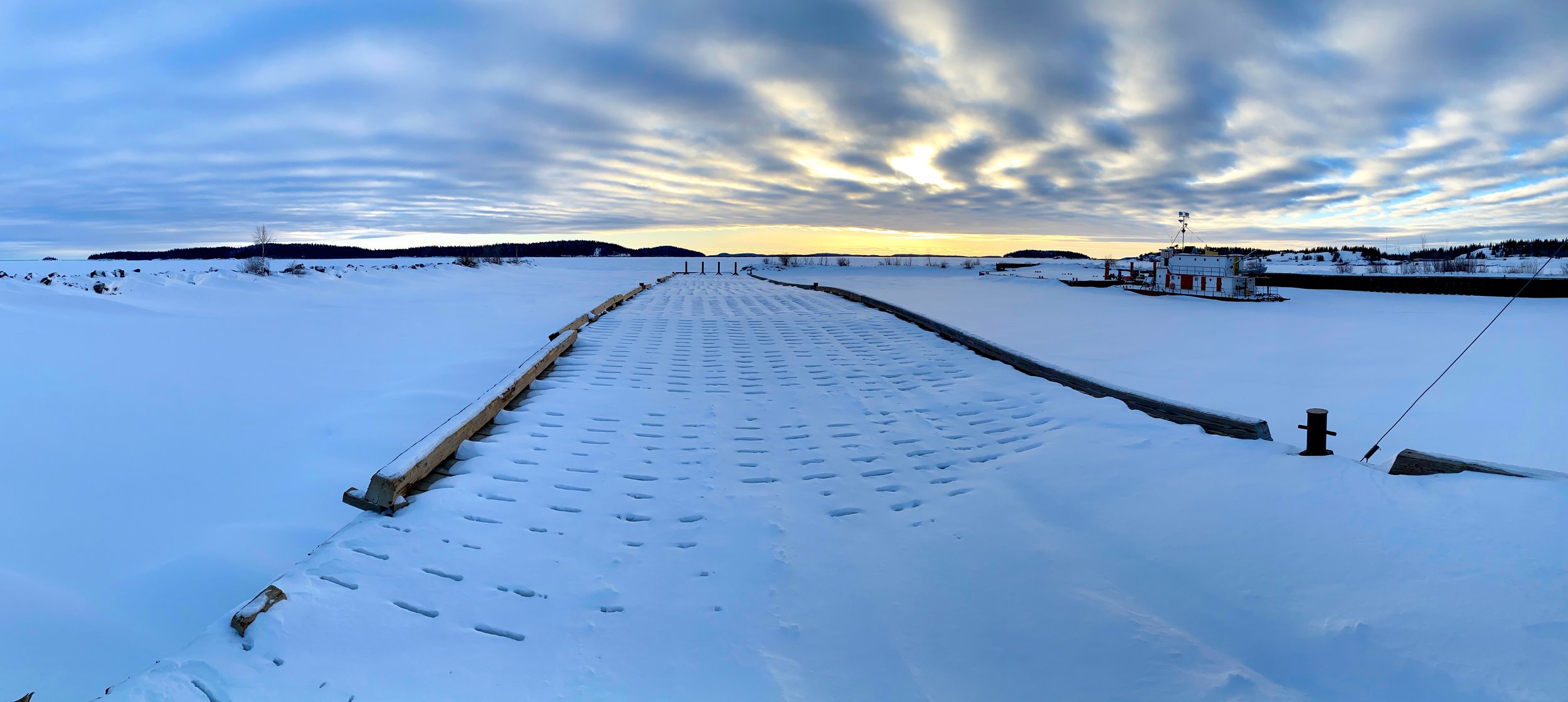
Fort Chipewyan and Lake Athabasca


Arriving at the Fort Chipewyan Airport around 3:30pm, and having scoped out our camp spot for the night, we still had some time to head into town and snoop about. It’s only about a ten minute drive from the airport, but we took it slow and did a bit of sightseeing along the way to look at some of their infrastructure. After all, this isn’t some easily reached town with normal road access and traffic passing through all day. In fact, we were probably the only “tourists” in town.
The roads were well plowed, but there was still a thin skiff of snow, and in some places, ice left for us to deal with. They didn’t use salt up here as that would also have to be brought in by ice road in the winter time. But they did use sand to help with traction here in the township.
We arrived in town in time to drive once around it and then head to the town museum which was still open. This is unusual in our experience as museums up in the remote regions usually don’t stay open in the winter time. But here it was different, as the only time they got drive in visitors was winter. The rest of the year the only way in is by airplane or boat. Taking the boat route is a long one, as access to Lake Athabasca is by river from the east, and that river is accessed by a road that starts from central Saskatchewan. This road is entirely un-paved from the centre of Saskatchewan north, and subject to the ravages of climate. If we wanted to travel this route, it’s a 2,600 kilometre drive from Vancouver to Stony Rapids, then roughly 100 kilometres on the river west to the lake, and then over 283 kilometres on Lake Athabasca itself to reach Fort Chipewyan. So as you can imagine, using the winter road from Fort McMurray is certainly the preferred route.
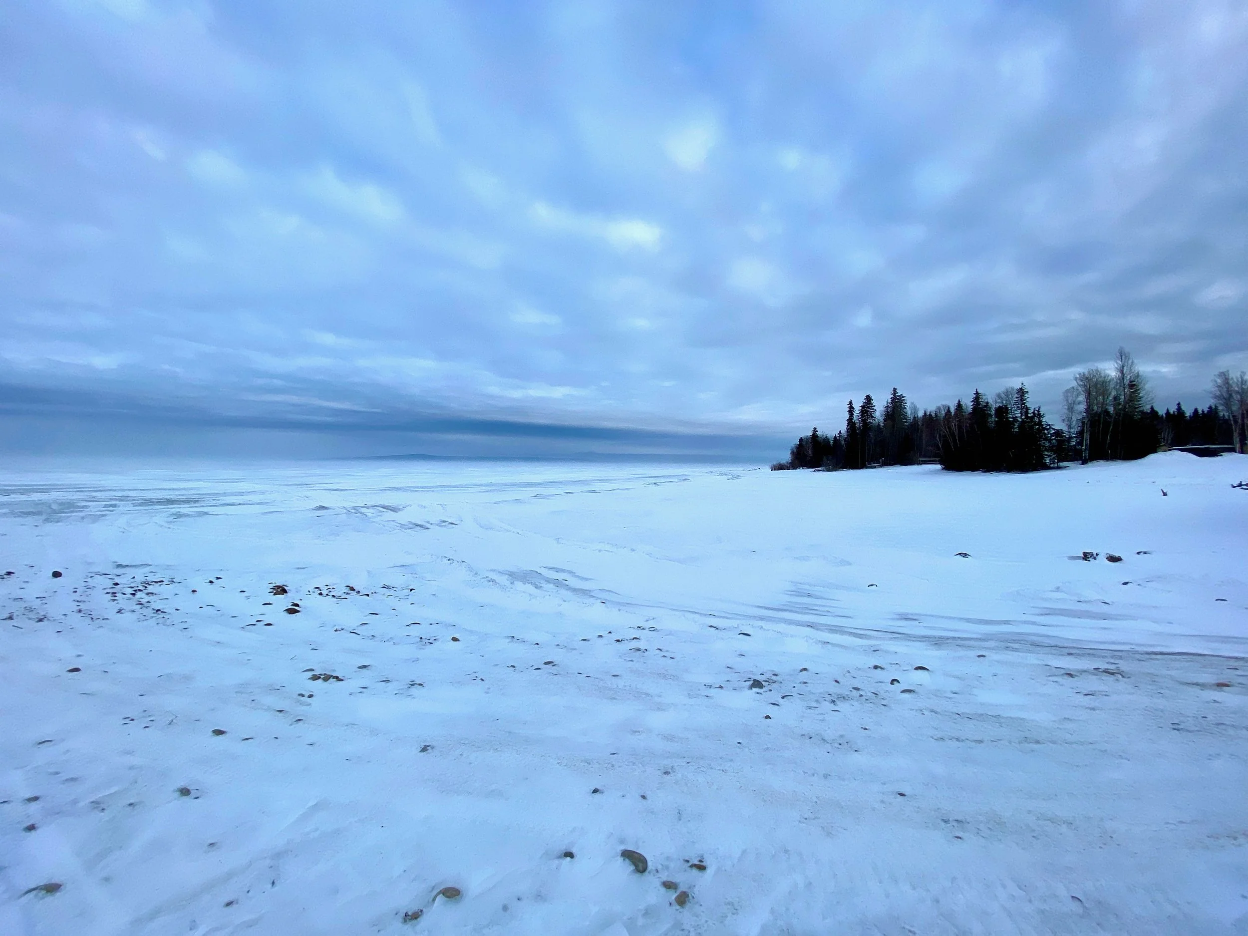
Our first good look at the 7,850 square kilometre (3,030 square mile) Lake Athabasca.


Sunset over Lake Athabaska in Fort Chipewyan.
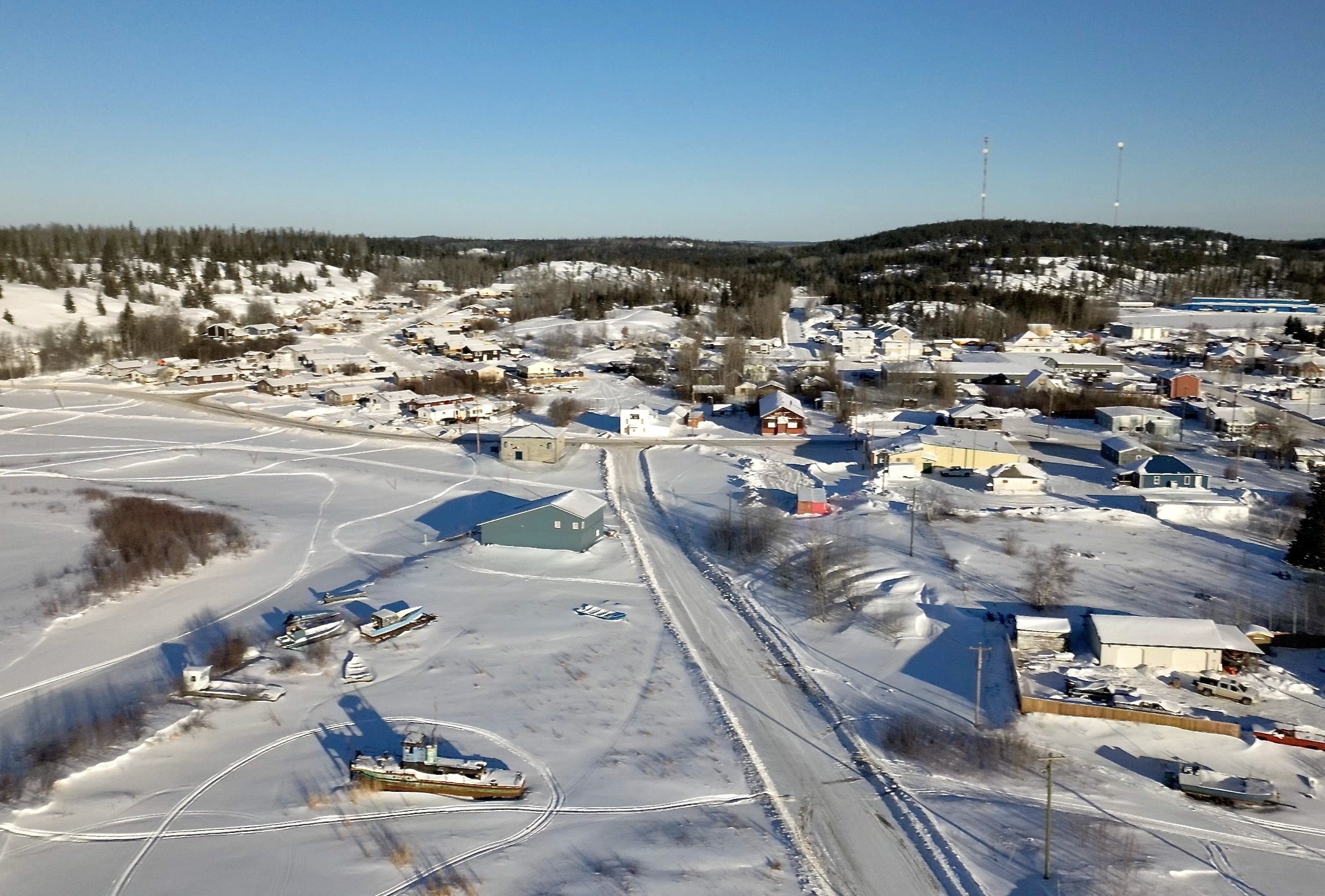
Aerial Shots of Fort Chipewyan


Driving Around Fort Chipewyan


On our second day in the town we drove around for a better look see. The day before we got in not long before twilight, and the low light wasn’t very flattering on the old town. But on this day, the sun was out in full force and the white snow was sparkling all about.
The usual thing we check before we get underway each day is a visual walk around of the truck to see everything is okay. This is when the true effect of driving on an ice road in the dead of winter came into full view. The back of the truck was well covered.


The main town is constrained between surrounding hills and the lake itself, but outside of the town there are roads that link to other neighbour areas which are mostly First Nations communities. We took the opportunity to drive through these areas, and although snow mostly covered all the ground, we could see that these neighbourhoods were for the most part well maintained. Most demonstrated the feeling of pride by the owners. Something lacking in many First Nation communities.


Heading Back Home
The start of the long journey home.
Having seen all that there was in Fort Chipewyan, and wanting to drive the northern ice road to Fort Smith in the Northwest Territories, we headed back past the airport and to the start of the winter road. There’s nothing nicer than driving a clean snow covered road with an electric blue sky and bright sunshine.
Before we get to the Fort Smith turnoff, we’d have to cross the same rivers we came in on. But now being seasoned veterans at crossing ice covered rivers, we just took it in stride. The first one was one of the branches of the massive Slave River. It’s a large river that snakes up towards the Northwest Territories and merges with the Peace River.


Returning from our aborted drive to the northern ice road, we sadly make our way back over familiar territory. In two days we’d reach the end of the winter ice road and finally, back to Fort McMurray.
But first, more rivers to cross on the 280 kilometre journey.


Mining Giants and Reclamation
On the way back to Fort McMurray we once again passed the giant Syncrude Reclamation Site where they were trying to undo the damage to the environment from their pursuit of fossil fuels. One can tell driving by it that a large number of people are employed here, as the barrack accommodation is set up right along the roadside.
Just beyond the site, on the opposite side of the road is a display of retired mining machines that are gargantuan in size. Our large truck could almost fit inside the bucket of the giant backhoe machine. Imagine how these machines were used to rape an pillage the environment for its “riches”. It makes one sick to think of what they could do with just a single scoop. Nevertheless they were impressive machines and the weather was favourable enough to put the drone up into the air for a birds eye view.


One Last Treat - Abraham Lake
The location of Abraham Lake.
As we backtracked on our route home, we took a detour to an area we hadn’t yet visited. That of Abraham Lake, a large body of water lying on the eastern edge of the Rocky Mountains, and on the route from Saskatchewan Crossing to Rocky Mountain House.
The lake was quite beautiful, and a bit of a paradox. The east end of the lake was only partially frozen, with lots of deep blue open water lapping at the edge of thin ice. But the western end of the lake was completely different. There the ice was complete, and several feet in thickness. What made this ice so amazing was it’s topography. Yes, that’s right, the ice was three dimensional with large waves frozen in shape and depth. A feature we’d not seen before. These waves likely caused by the constant wind pushing the surface of the lake to the west and forcing the ice into the finite surface area bounded by the shoreline. With enough force, the ice had no choice but to start deflecting vertically, both up and down. The result was this amazing landscape of frozen water, with metre high waves of rock hard H20.
Our parking spot at Preachers Point.
At the west end of the lake there was campsite that we were able to take advantage of. We found a quiet spot above the lake with a view from our window of ice and mountains. We were at the far end of the campsite with our nearest neighbour, a car with two pot smoking campers and a lonely dog tied up outside. We were thankful that the dog wasn’t being exposed to the toxic recreational drug the vehicle occupants felt compelled to use. Surrounded by such beauty and majesty, we wondered why anyone would need mind altering drugs to feel on another plane. It was at this spot that we got the best photo of the entire trip.


The cold, high wind environment outside the rig that evening provided little incentive to go out onto the ice for photos. Since we had been experiencing fine weather for some days we figured we’d just wait until morning to see what we could shoot. But waking the next day showed us dark overcast skies and flat light. The worst possible conditions for photography.
Fortunately, as we waited around pondering on what to do, a small break in the clouds gave us hope. So after gearing up to go down onto the ice, the sun pushed through just enough to create this perfect scene. One of the most unique images I’ve ever taken. What a way to end an extraordinary trip.
West end of Abraham Lake. February 12th, 2023 09:30hrs.