A Week Of Island Summer
July, 2021
The track of our route as we traveled around Vancouver Island.
With pandemic restrictions easing due to vaccine implementation and warmer weather, we felt it appropriate to get the truck out of mothballs and take a short trip to see how it, and we, would do getting back out onto the road.
From our location, the quickest way out of town was to catch the ferry that embarks from a few kilometres away and crosses the strait to Vancouver Island. Once there, unpopulated areas aren’t too far away. On this trip, we wanted to visit some of the outlying locations that we haven’t been to. These would include Port Renfrew, Bamfield, Gold River and Tahsis. To do this we’d be using the backroads to travel between locations, so this would allow us to see a lot of countryside that most tourists wouldn’t see.
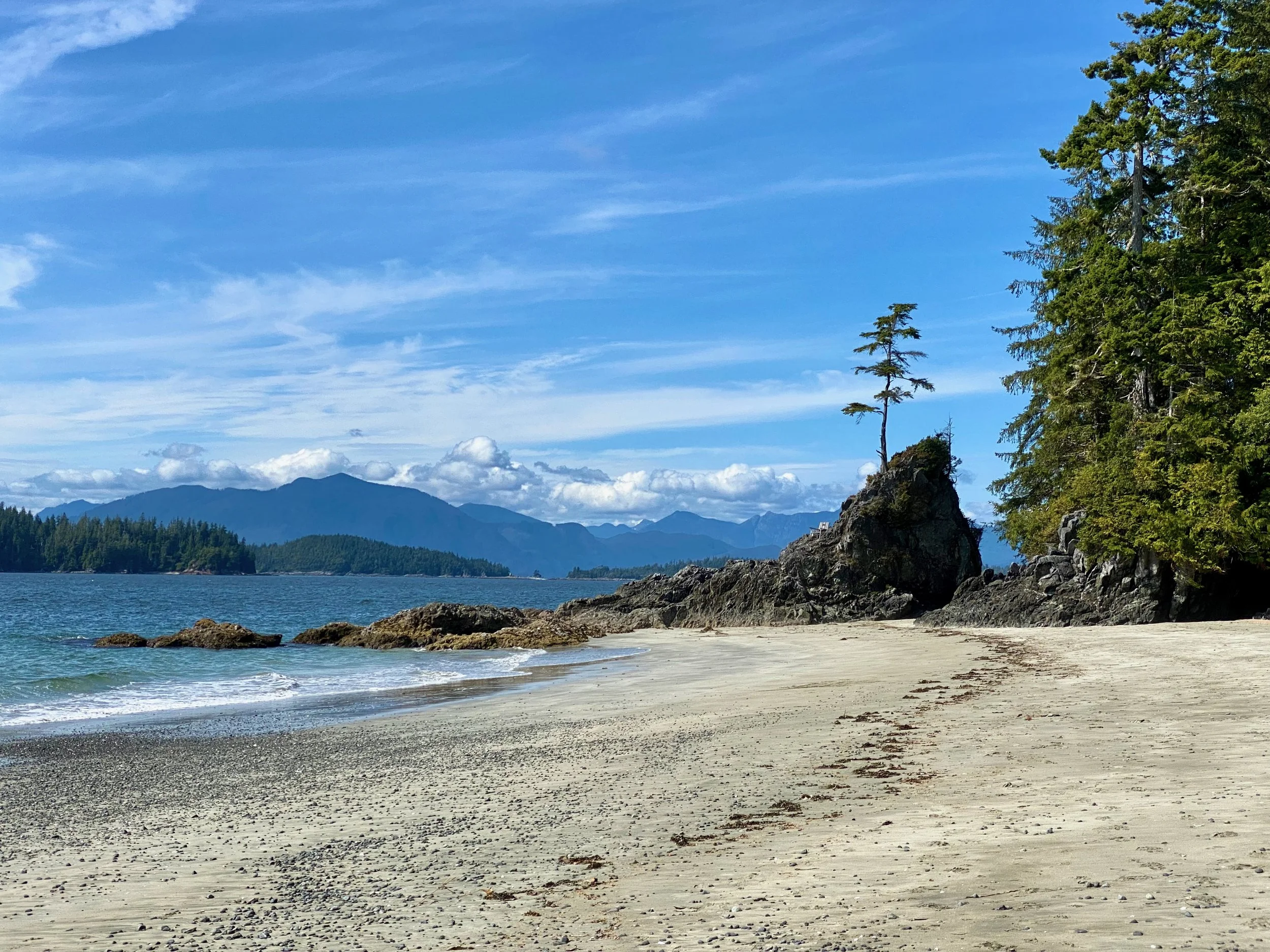
Looking out toward the Pacific Ocean from Port Renfrew.
Port Renfrew
Our route to Port Renfrew on the Pacific Coast side of Vancouver Island.
Making our way from Nanaimo where the ferry landed, to Port Renfrew on the west coast took a number of hours because we made some stops along the way.
One such stop was at a new tourist attraction on the Mallahat Highway south of Duncan. It was a giant tower constructed so people could get a better view of the strait. But despite stopping there, we never saw the tower. We were stopped by the price of admission. They wanted $80 for the two of us to enter, and it just seemed like a lot of money for a look at the strait. Especially when there was a pull-in viewpoint a few hundred metres up the road that gave us the same view for free. We still remember when $80 was considered a lot of money, so unlike many tourists today, we’re loath to part with it when there’s another, less crowded option.
The very small community of Port Renfrew.
Pulling into Port Renfrew, one can see that it’s tiny. There’s a fuel stop, a general store, a half dozen tourist accommodations, and the marina. It has a resident population of only 150, so aside from the tourist accommodation, there’s not a lot to see or do.
It’s the gateway to the Port of San Juan, a large natural harbour on the Pacific Coast, and sits alongside Juan De Fuca Provincial Park. We spent a few hours looking around and talking with a few people, and then we moved on.


Heading To Cowichan Bay
Our route to Cowichan Lake was by a decommissioned logging road. Many roads on Vancouver Island, and indeed all of B.C. all started as logging roads.
The route to Cowachin Bay is a back road without the comfort of pavement. Despite that, it has the advantage of being the shortest distance between two points. It also takes us past perhaps the most photographed tree in B.C., a small sprig growing from a lake-bound deadhead. Known as the Fairy Lake Bonsai Tree, it gets regular visits on most days from all manner of photographers.
The Fairy Lake Bonsai Tree.


Bamfield, Start Of The British TransPacific Telegraph Line
Our backroad route from Cowichan Lake to Bamfield on the west coast.
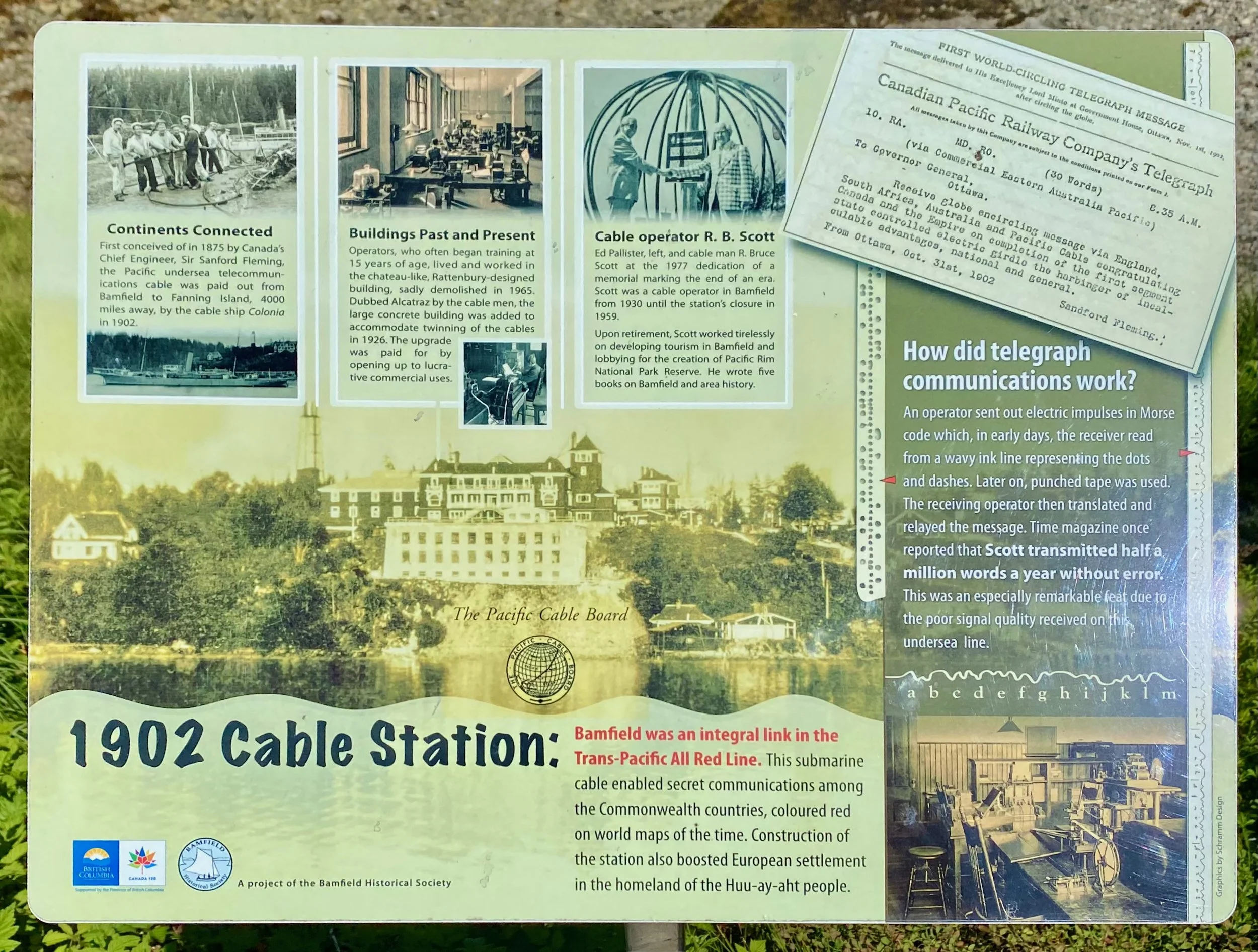
Bamfield may seem like a tiny, unimportant settlement on the extreme west coast of Vancouver Island, but in fact, at one time it was one of the most important towns in Canada.
You see, it was chosen to be the starting point for the final leg of a telegraph communication system for the British Empire that would stretch all around the world. Completed in 1902, this line stretched from Bamfield, British Columbia, underwater all the way to Southport, Queensland, in Australia. That historical infrastructure can still be seen from the harbour today when visiting Bamfield.
The upper left building is the original telegraph facility installation circa 1902.
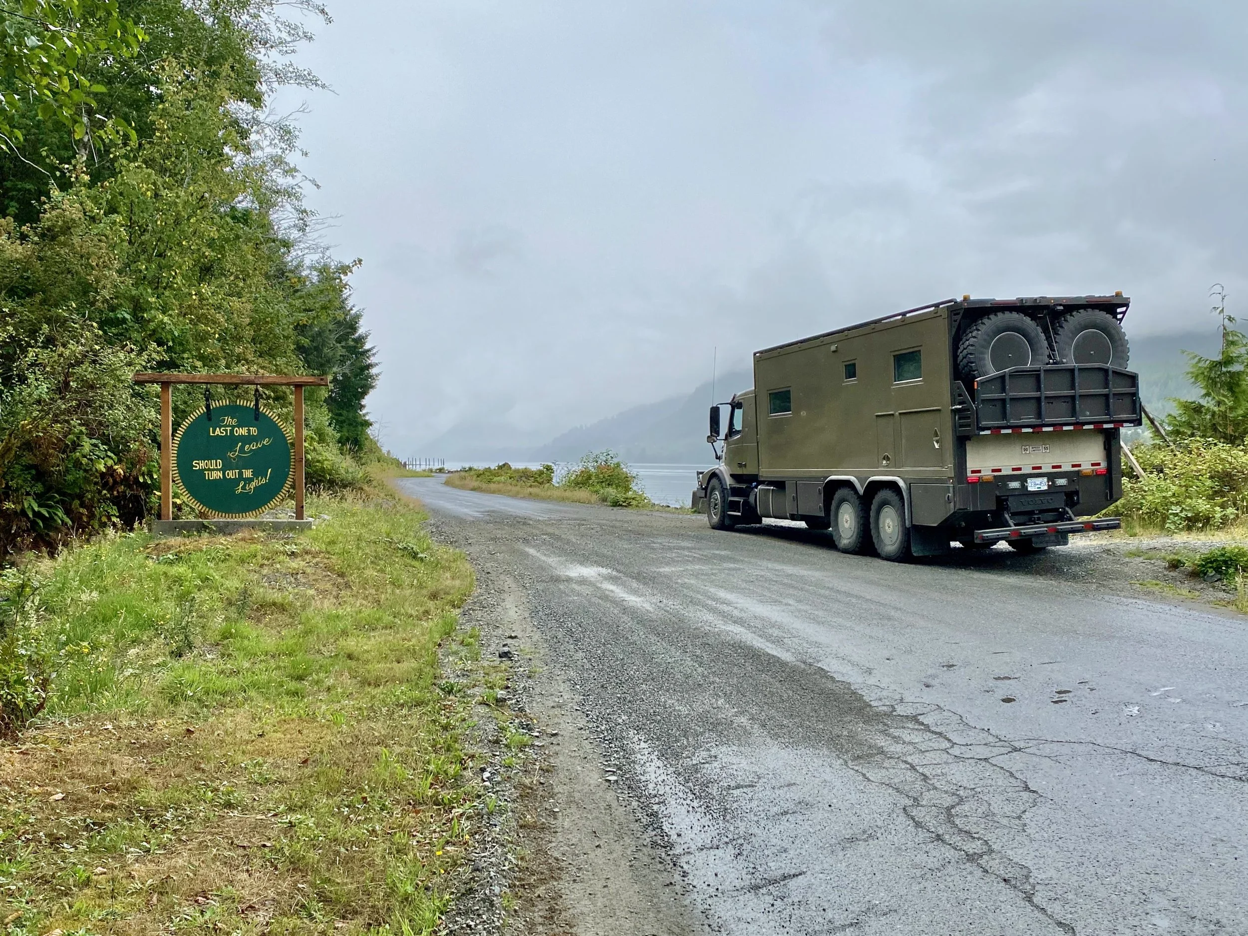
The drive to Bamfield from our Cowichan Lake bush camp was a bumpy one, as sections of the unpaved road were in very rough repair. It was on this trip that we finally decided we needed to invest in the tire inflation system for the truck. We had to continuously inflate and deflate the tires to match the road conditions, and this took hours over the course of the trip. What made this critical is that there were sections of paved and unpaved road, where we wanted soft tires for the extremely rough parts, and hard tires for the paved parts. Many times each section of road type was only a few kilometres long, so demanded the change. We could have left the tires fully inflated for the gravel sections, but then there was the fear that our teeth fillings might fall out. And leaving the tires deflated for the pavement, no matter how short, was a bad thing. Labrador taught us that pavement and deflated tires means excessive wear to our Michelin XZL tires, especially on the front. Something we didn’t want to experience a second time… it’s expensive.
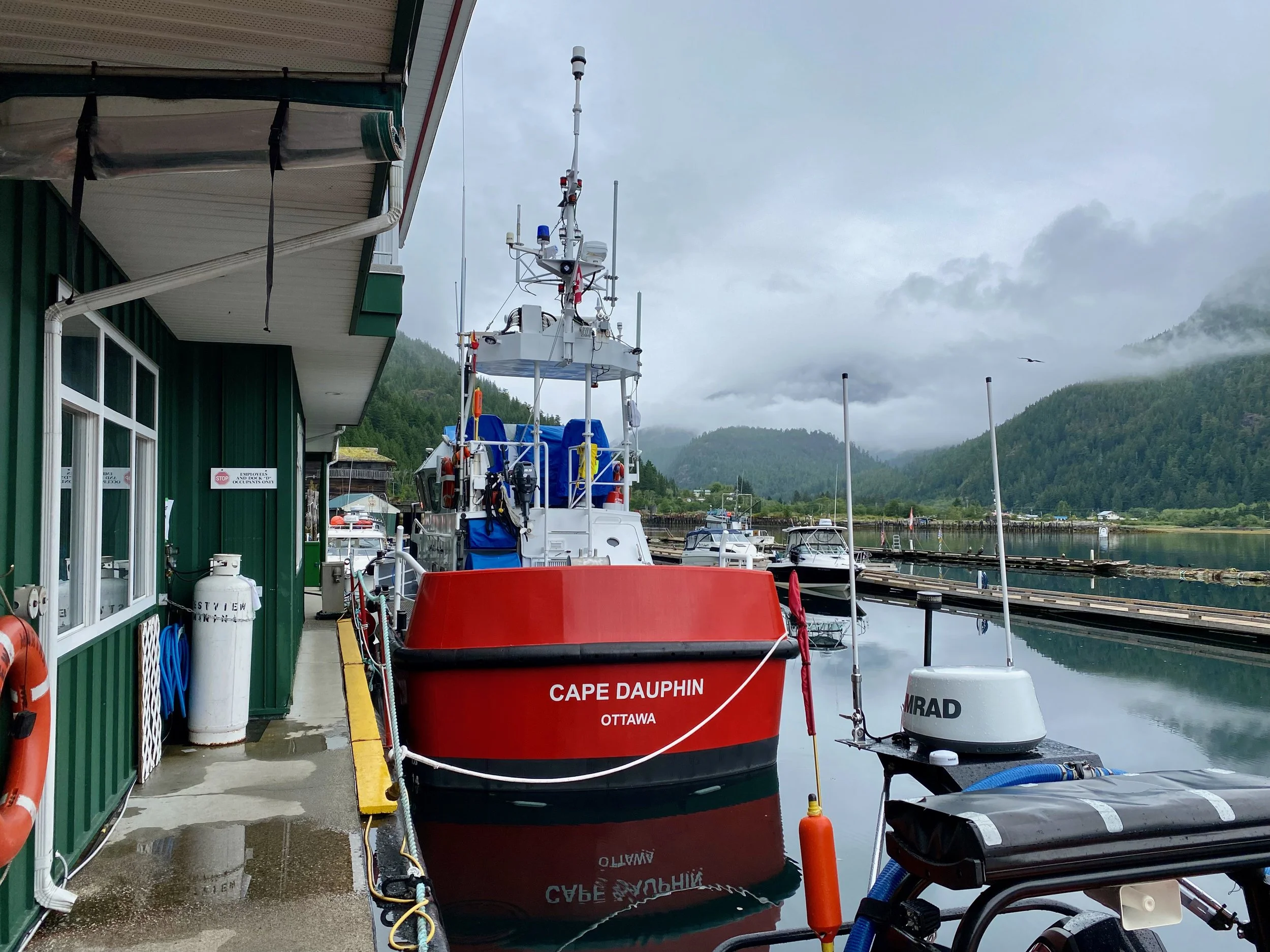
Parking was secured across the street from the harbour in a private lot of a home being upgraded for future short term rental.
Rolling into Bamfield in a large truck has one problem that needs to be solved right away, that being where to park. The township is concentrated along a few roads on the water’s edge. Parking consisted of the hotel lot, too small, or the road, too narrow. After driving around for a bit, and chatting to a few locals, we found a spot to park on private property right at the centre of “town”.
The original harbour buildings from the early 1900s. Repurposed over the years, but historically maintained.
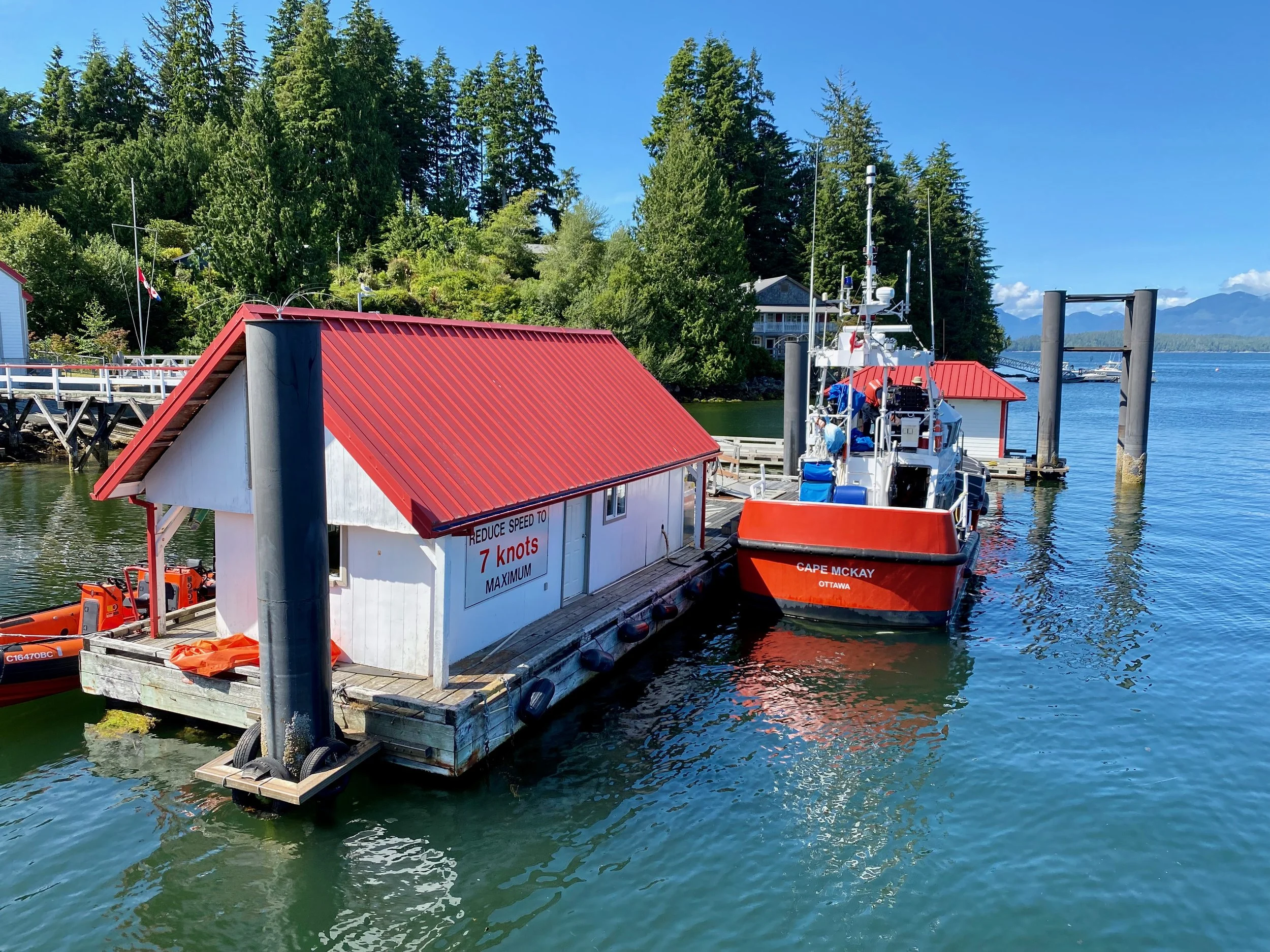
Talking with the owner of our parking spot gave us some good information of places to visit, and how to get around the harbour. A good portion of Bamfield is on the far side of the harbour, but it’s not accessible by road. So a harbour water taxi is used to cross to the other side.


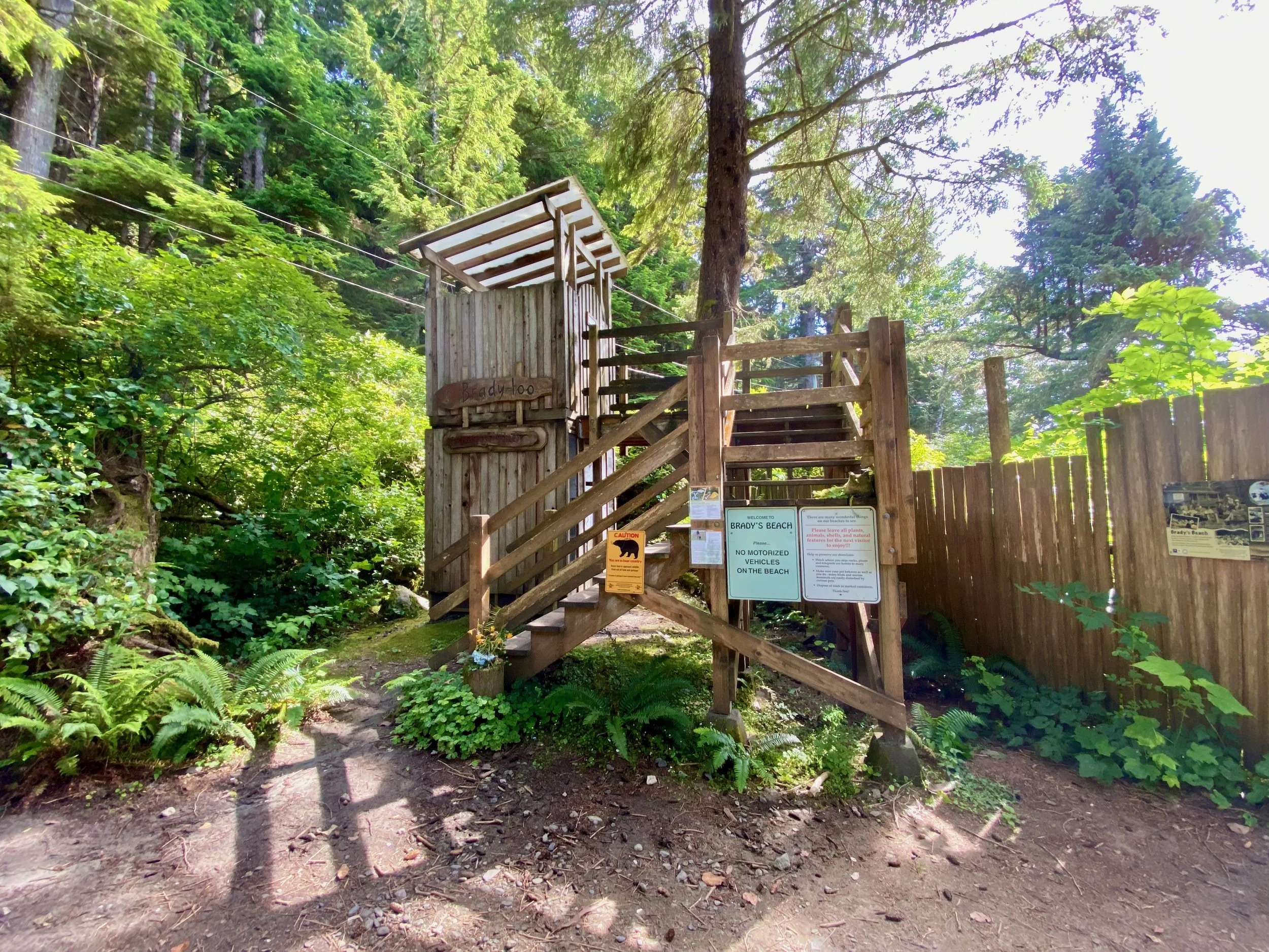
The water taxi was a simple pontoon boat run by a local woman who came recommended by the fellow who’s property we were parked on. He was pushing her over a new startup that was trying to undercut her rates to steal the business. So at his recommendation, we paid the $28 each for the return trip to reach the other side of the harbour. Once there, we could start our exploration of the historical part of the port, the general store, the coast guard base and the very impressive Brady’s Beach on the outside of the peninsula. For that, however, we’d have to undertake a hike which included a very long, very steep hill to the Pacific side shoreline.


A Round About Way To Gold River
Although it says the drive is only five hours, we actually broke it up into several days.
The next stop on our tour of remote communities was Gold River. Although it’s almost centre of the island side to side, it’s more connected geographically to the west coast and Pacific Ocean. The town centre is 14 kilometres from the port, which is on a long fiord that connects Gold River to the Pacific Ocean.
Founded on the logging and pulp industry, and incorporated in 1967, it survived on that until the mill closed in 1998. From then on, the residents that remained are largely supported by the tourist industry. The port is the gateway to the Nootka Sound recreation area where people charter float plane or boat to explore the various islands offshore. The port also offers refuge to boaters exploring up the west coast of the island and beyond.
One float plane on its taxi out from the dock, with another having just taken off in the background.
Before heading up to Gold River we paid a short visit to the east side of the island, and Parksville, to have a gander at the amazing beach there. From there we stopped at a friend’s place in Courtenay for an overnight visit before heading up island.


Gold River, B.C.


Compared with the unpaved roads to Bamfield that were in such bad repair, the road to Gold River was paved and in good shape. A drive of only one and a half hours from the main highway on the east coast brought us to Gold River.
It’s a town you can drive around in fifteen minutes or less, with very little to offer in the way of amenities for the average tourist. But those that come here do so for more adventurous pursuits like hiking the Elk Lake Trail or the Nootka Island Trek, or rock climbing the Crest Creek Crags. Fishing and eco-tourism are both well supported. Gold River also has the distinction of being the closest town to Yuquot, the cove where Captain James Cook first came ashore on March 31, 1778. This was the era when the first Europeans set foot on what would become Vancouver Island.


Tahsis - The End Of The Road


Accessed by the same road from the east-side Island Highway, getting to Tahsis happens by hanging a right just as one enters the town of Gold River. The paved road carries on for a few kilometres but eventually becomes a gravel road for the rest of the way to Tahsis.
The sign in Tahsis says it has been a community since 1792, but the history is a bit disjointed in that it was the time of the European explorer visitations. Various claims on the land by different countries were eventually resolved when the Spanish withdrew after a treaty was signed with the English. The native inhabitants once again got possession of their home turf with the vacated Spanish buildings being taken by the various chiefs of the area. The most powerful chief got the largest building. No surprise there. The area remained largely unchanged until around 1900 when logging started and a sawmill was planned. Logging has since reduced dramatically, and now the main industry is tourism. Only a few hundred residents remain in the area.
The puzzle for us was why, in the middle of the summer when tourism is at its peak, there was so little activity. The town was virtually deserted, and the harbour, which one would think would be a beehive of activity with sport fishing and such, was essentially vacant. Besides us, one other young couple wandering around, and a couple of staff at the dock cafe, there was nobody.
The riparian restored, and now pristine, inlet estuary.